Mansfeld-Lutherstadt in Mansfeld-Südharz, Saxony-Anhalt, Germany — Central Europe
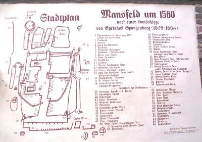
Mansfeld um / in 1560
von Cyriakus Spangenberg
[Stadtplan und Schlüssel]
Material und Putzarbeiten gesonsert von Firma KNORR Bau GmbH
Entwurf und Ausführung Günter Bormann und Siegfried Bösel
——————————
after a hand sketch by Cyriacus Spangenberg
[map and key]
Material and plaster work provided by KNORR Bau GmbH
Design and execution by Günter Bormann and Siegfried Bösel
Erected by Heimatsverein Mansfeld-Lutherstadt.
Topics. This historical marker is listed in these topic lists: Man-Made Features • Settlements & Settlers.
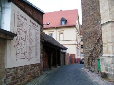
Location. 51° 35.59′ N, 11° 27.168′ E. Marker is in Mansfeld-Lutherstadt, Sachsen-Anhalt (Saxony-Anhalt), in Mansfeld-Südharz. Marker is on Junghuhnstraße just east of Lutherstraße, on the right when traveling east. Touch for map. Marker is in this post office area: Mansfeld-Lutherstadt ST 06343, Germany. Touch for directions.
Other nearby markers. At least 8 other markers are within walking distance of this marker. Mittelalterliches Straßenpflaster (here, next to this marker); Scherren (a few steps from this marker); St. George's, Martin Luther's Home Church (a few steps from this marker); War Memorial (within shouting distance of this marker); Luthers Schule / Luther's School (within shouting distance of this marker); a different marker also named Luthers Schule / Luther's School (within shouting distance of this marker); Mansfeld Brunnen / Well (about 90 meters away, measured in a direct line); History of the [Luther] House (about 120 meters away). Touch for a list and map of all markers in Mansfeld-Lutherstadt.
Also see . . .
1. Cyriacus Spangenberg. (Submitted on November 23, 2013, by William Fischer, Jr. of Scranton, Pennsylvania.)
2. Einheitsgemeinde Stadt Mansfeld. (Submitted on November 23, 2013, by William Fischer, Jr. of Scranton, Pennsylvania.)
Credits. This page was last revised on January 28, 2022. It was originally submitted on November 23, 2013, by William Fischer, Jr. of Scranton, Pennsylvania. This page has been viewed 420 times since then and 4 times this year. Photos: 1, 2. submitted on November 23, 2013, by William Fischer, Jr. of Scranton, Pennsylvania.

