Shockoe Bottom in Richmond, Virginia — The American South (Mid-Atlantic)
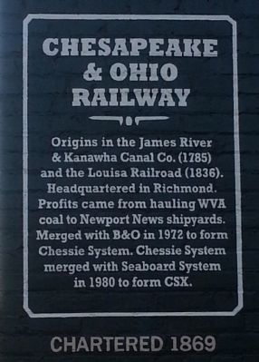
Chesapeake & Ohio Railway
Chartered 1869
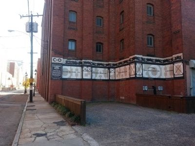
Church Hill Tunnel, 1873 • 18th & east Marshall
Main Street Station, 1901 • 15th & East Main
Penisula Trestle, 1901 • Elevated track to the right
James River Viaduct, • 1901 East Dock Street
Triple Crossing, 1901 • Near 15th & East Dock Street
Erected 2012 by 1717 Design Group.
Topics. This historical marker is listed in these topic lists: Industry & Commerce • Railroads & Streetcars. A significant historical year for this entry is 1972.
Location. 37° 31.934′ N, 77° 25.73′ W. Marker is in Richmond, Virginia. It is in Shockoe Bottom. Marker is at the intersection of East Cary Street and South 18th Street, on the right when traveling east on East Cary Street. Located at the northwest corner of the building. Touch for map. Marker is in this post office area: Richmond VA 23223, United States of America. Touch for directions.
Other nearby markers. At least 8 other markers are within walking distance of this marker. Capital Trees (about 300 feet away, measured in a direct line); Richmond Local Flood Protection (about 300 feet away); Canal Walk / Historic Canals (about 300 feet away); Virginia Capital Trail (about 300 feet away); Lincoln's Visit to Richmond (about 300 feet away); African Americans and the Waterfront (about 700 feet away); In a wooden crate similar to this one… (about 700 feet away); The Oldest Commercial Building in Richmond (about 800 feet away). Touch for a list and map of all markers in Richmond.
Also see . . .
1. Chesapeake and Ohio Railway. Wikipedia (Submitted on November 29, 2013.)
2. History of the C&O Railway. Chesapeake and Ohio Historical Society (Submitted on November 29, 2013.)
Credits. This page was last revised on February 1, 2023. It was originally submitted on November 29, 2013, by Bernard Fisher of Richmond, Virginia. This page has been viewed 577 times since then and 19 times this year. Photos: 1, 2, 3. submitted on November 29, 2013, by Bernard Fisher of Richmond, Virginia.


