Folsom in Sacramento County, California — The American West (Pacific Coastal)
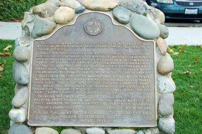
Natomas Consolidated of California
Early partners engaged in water, granite quarrying, agriculture, vineyards, gold mining, hydro-electric power and helped build Folsom Prison and historic Folsom Powerhouse. After 1900, Natomas began gold dredging operations. Estimates are that one hundred million dollars in gold were taken from this Folsom field. The last of seven working dredgers was dismantled in 1962 and sent to South America.
Here stood the town of Natomas, Natomas offices, water tower, machine shop, retort house (where gold was melted and poured into bars), train station, post office and company homes. All buildings were painted yellow and employees were know as "Yellow Town Kids." Street names were "Whiskey Row," "Rowdy Ridge" and "Poverty Gulch."
Dredging was interrupted during World War II. Converted machine shops produced parts for the Department of the Navy, earning Natomas Company the Army/Navy "E" Award.
Ties of a common past still bind Natomas Co. with Folsom.
Erected 1988 by Natomas Real Estate Company and Folsom Historical Society.
Topics. This historical marker is listed in these topic lists: Agriculture • Industry & Commerce • Settlements & Settlers. A significant historical year for this entry is 1857.
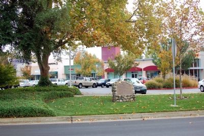
Location. 38° 39.255′ N, 121° 10.952′ W. Marker is in Folsom, California, in Sacramento County. Marker is at the intersection of Blue Ravine Road and Folsom Boulevard, on the left when traveling west on Blue Ravine Road. The marker is next to the Jamba Juice smoothie store. Touch for map. Marker is at or near this postal address: 13389 Folsom Blvd #400, Folsom CA 95630, United States of America. Touch for directions.
Other nearby markers. At least 5 other markers are within 2 miles of this marker, measured as the crow flies. Southern Pacific Railroad Superintendent's House (approx. 1.1 miles away); St. John the Baptist Catholic Church (approx. 1.3 miles away); The Young Wo Memorial Site (approx. 1.3 miles away); Rancho Rio de los Americanos (approx. 1.4 miles away); Folsom Terminal (approx. 1˝ miles away). Touch for a list and map of all markers in Folsom.
Credits. This page was last revised on December 19, 2019. It was originally submitted on November 22, 2006, by Karen Key of Sacramento, California. This page has been viewed 3,308 times since then and 95 times this year. Photos: 1, 2. submitted on November 22, 2006, by Karen Key of Sacramento, California. • J. J. Prats was the editor who published this page.

