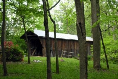
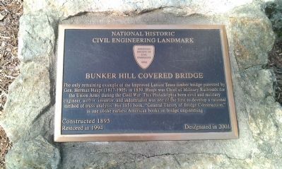
Near Claremont in Catawba County, North Carolina — The American South (South Atlantic)
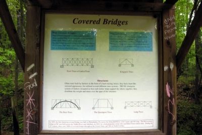
Covered Bridges
Why Covered Bridges:
They protect exposed wooden superstructures from rot resulting from exposure to the elements (rain, sleet, snow, and blazing sun).
An uncovered wooden bridge's life span would be 15-20 years; but with a roof and sides, one would last as long as a hundred years.
Misconceptions:
Wooden bridges prevented heavy snows from covering and/or blocking passage.
Barn-like appearance soothed animal fears of bridge crossing (prevented horses from bolting).
Covered bridges protected travelers from the sun.
Structures
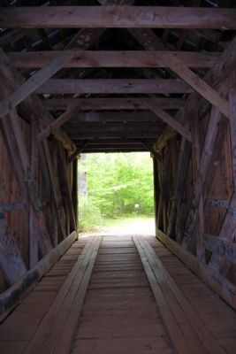
Often were built by farmers in the form of a bard-raising; hence, they had a barn-like outward appearance, but utilized several different truss systems. TRUSS: triangular system of timbers designed so that each timber helps support the others; together, they distribute the weight and stress over the span of the structure.
In 1805, the first American covered bridge was built in Philadelphia, PA, across the Schuylkill River, with 3 spans and 550' long. The first covered bridge in NC was built across the Yadkin River near Salisbury, in 1818, by a local plantation owner who used Ithiel Town's lattice truss. During the 19th century, there were 1000s of covered bridges throughout the United States and 100s in North Carolina.
Topics and series. This historical marker is listed in this topic list: Bridges & Viaducts. In addition, it is included in the Covered Bridges series list. A significant historical year for this entry is 1805.
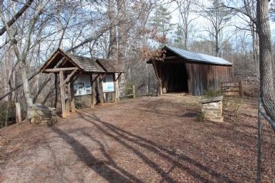
Location. 35° 43.288′ N, 81° 6.926′ W. Marker is near Claremont, North Carolina, in Catawba County. Marker can be reached from U.S. 70, 0.2 miles east of Bridgewood Drive, on the left when traveling east. Marker and bridge are not accessible by vehicle. They are reached by a short (less than 1/4 mile) hike from the parking lot. Touch for map. Marker is in this post office area: Claremont NC 28610, United States of America. Touch for directions.
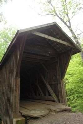
Other nearby markers. At least 8 other markers are within 5 miles of this marker, measured as the crow flies. Bunker Hill Covered Bridge (here, next to this marker); Herman Haupt (here, next to this marker); a different marker also named Bunker Hill Covered Bridge (approx. 0.2 miles away); Catawba POW/MIA Monument (approx. 2.4 miles away); Catawba High School World War I Memorial (approx. 2.4 miles away); Town of Catawba Veterans Garden of Honor (approx. 2.4 miles away); Town of Catawba (approx. 2.4 miles away); St. John's Church (approx. 4˝ miles away). Touch for a list and map of all markers in Claremont.
Credits. This page was last revised on June 16, 2016. It was originally submitted on December 3, 2013, by Duane Hall of Abilene, Texas. This page has been viewed 447 times since then and 21 times this year. Photos: 1. submitted on December 3, 2013, by Duane Hall of Abilene, Texas. 2. submitted on December 29, 2011, by Jamie Cox of Melbourne, Florida. 3, 4, 5. submitted on December 3, 2013, by Duane Hall of Abilene, Texas. 6. submitted on December 29, 2011, by Jamie Cox of Melbourne, Florida.
