Anoka in Anoka County, Minnesota — The American Midwest (Upper Plains)
Highway of Exploration
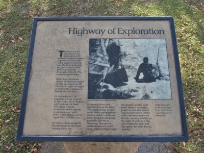
The Rum and the Mississippi were highways for the earliest recorded European explorers of Minnesota. Many explorers traveled past The Point and some may have camped here including Radission, Hennepin, Du Luth, Pike, Faribault and Nicollet.
Father Louis Hennepin canoed by The Point in July of 1680 as a captive of the Dakota and again in August of 1680 in the company of Daniel Sieur Du Lhut.
In November of 1767 Jonathan Carver stopped at The Point. He is credited with naming the Rum River from a faulty translation of the Dakota words meaning "spirit river" which flowed out of "spirit lake" or Mille Lacs.
In 1836 explorer Joseph N. Nicollet stood at The Point looking down the Mississippi River and recorded this in his diary: "We stopped here so that I could make a geographical reading at this confluence while breakfast was being prepared. The site is charming. The view is unobstructed on the left bank, which is higher than the densely wooded right bank. There is an endless prairie on one side and an impenetrable forest on the other; obvious sterility on the left, seeming fertility on the right. It looks as if one part awaits the plow and the spade, the other the ax and fire."
Topics and series. This historical marker is listed in these topic lists: Exploration • Native Americans • Waterways & Vessels. In addition, it is included in the Minnesota Historical Society series list. A significant historical month for this entry is July 1680.
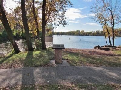
Location. 45° 11.418′ N, 93° 23.445′ W. Marker is in Anoka, Minnesota, in Anoka County. Marker can be reached from South Ferry Road, 0.3 miles east of South Ferry Street (U.S. 169). Marker is in Peninsula Point Park. Touch for map. Marker is at or near this postal address: 1460 South Ferry Parkway, Anoka MN 55303, United States of America. Touch for directions.
Other nearby markers. At least 8 other markers are within walking distance of this marker. Circle of Life (a few steps from this marker); River Highways (about 300 feet away, measured in a direct line); Logbooms Meet Sawmills (about 400 feet away); Fireman's Grove (about 400 feet away); Where Cultures Meet (about 500 feet away); Where Land and Water Meet (about 600 feet away); Bridging the Mississippi (about 600 feet away); Who Lived Here / Neighborhood Names / Building a Community (approx. 0.2 miles away). Touch for a list and map of all markers in Anoka.
More about this marker. painting caption: Father Hennepin on the Mississippi River, 1680. From a painting by J.N. Marchand. Courtesy the Minnesota Historical
Society.
Also see . . . Rum River. Wikipedia entry. "The Rum River is a slow, meandering channel that connects Minnesota's Mille Lacs Lake with the Mississippi River. It runs for 151 miles..." (Submitted on December 3, 2013.)
Credits. This page was last revised on June 16, 2016. It was originally submitted on December 3, 2013, by Keith L of Wisconsin Rapids, Wisconsin. This page has been viewed 791 times since then and 17 times this year. Photos: 1, 2, 3. submitted on December 3, 2013, by Keith L of Wisconsin Rapids, Wisconsin.


