Petersburg, Virginia — The American South (Mid-Atlantic)
The Crater
Inscription.
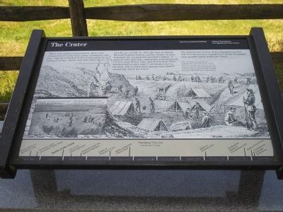
“There was utmost consternation. Some men scampered out of the lines; some, paralyzed with fear, vaguely scratched at the counterscarp as if trying to escape. Smoke and dust filled the air.”
- Col. William McMaster, 17th South Carolina Infantry
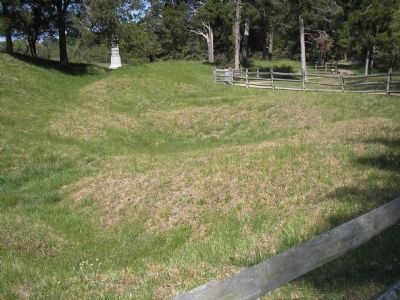
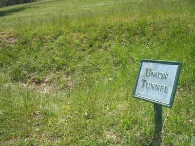
At 4:40 a.m. on July 30, 1864, the men of Captain Richard Pegram’s battery and two South Carolina regiments lay sleeping here at Elliot’s Salient. A moment later, this place turned into a smoking hole 170 feet long, 80 feet wide, and 30 feet deep. Two hundred and seventy-eight Confederates died in the blast. Two 1,700-pound cannons were hurled completely out of the works.
The depressions of four of the magazines (rooms that held the powder) exploded by Colonel Pleasants’s men are still visible inside the Crater.
Erected by Petersburg National Battlefield - National Park Service - Dept. of the Interior.
Topics. This historical marker is listed in this topic list: War, US Civil. A significant historical month for this entry is July 1862.
Location. 37° 13.115′ N, 77° 22.65′ W. Marker is in Petersburg, Virginia. Marker can be reached from Siege Road, on the right when traveling south. Marker is in Petersburg National Battlefield. It is located on a walking trail that starts at Tour Stop 8. Touch for map. Marker is in this post office area: Petersburg VA 23803, United States of America. Touch for directions.
Other nearby markers. At least 8 other markers are within walking distance of this marker. “A Stupendous Failure” (here, next to this marker); Confederate Counterattack (here, next to this marker); Crater of Mine (here, next to this marker); Confederate Countermine (a few steps from this marker); Mahone (within shouting distance of this marker); Union High Tide (within shouting distance of this marker); Second Pennsylvania Veteran Heavy Artillery (within shouting distance of this marker); South Carolina (within shouting distance of this marker). Touch for a list and map of all markers in Petersburg.
More about this marker. The background of the marker is a picture of soldiers camping in the vicinity of the Crater. It has a caption of After the battle on July 30, the Confederates incorporated the Crater into their earthworks. Years of erosion and the removal of 669 bodies from the Crater and surrounding fields in 1866 have altered the site’s appearance.
The lower left of the marker features a post-war photograph of the Crater with the caption Since the 1860s the Crater has been a popular spot for tourists. This photo was taken in 1867. Note the skull at the bottom of the picture.
Like many other
markers in Petersburg National Battlefield, this one has a Petersburg Time Line at the bottom. The Battle of the Crater is indicated on it.
Related markers. Click here for a list of markers that are related to this marker. Battle of the Crater by markers.
Also see . . .
1. Crater. CWSAC Battle Summaries. (Submitted on April 12, 2008, by Bill Coughlin of Woodland Park, New Jersey.)
2. Petersburg National Battlefield. National Park Service. (Submitted on April 12, 2008, by Bill Coughlin of Woodland Park, New Jersey.)
3. Battle of the Crater. The Civil War Siege of Petersburg (Submitted on April 12, 2008, by Bill Coughlin of Woodland Park, New Jersey.)
Library of Congress
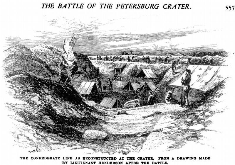
4. The Battle of the Petersburg Crater:
The Confederate Line as Reconstructed at the Crater
The Confederate Line as Reconstructed at the Crater
After the battle on July 30, the Confederates incorporated the Crater into their earthworks. Years of erosion and the removal of 669 bodies from the Crater and surrounding fields in 1866 have altered the site’s appearance.
From a drawing made by Lieutenant Henderson after the battle - Battles and Leaders of the Civil War, 1st ed., v. 4, p. 557.
Credits. This page was last revised on February 2, 2023. It was originally submitted on April 12, 2008, by Bill Coughlin of Woodland Park, New Jersey. This page has been viewed 3,268 times since then and 23 times this year. Photos: 1, 2, 3. submitted on April 12, 2008, by Bill Coughlin of Woodland Park, New Jersey. 4. submitted on November 6, 2020, by Allen C. Browne of Silver Spring, Maryland. 5. submitted on April 13, 2008, by Bill Coughlin of Woodland Park, New Jersey. • Craig Swain was the editor who published this page.
