Sharpsburg in Washington County, Maryland — The American Northeast (Mid-Atlantic)
Companies G. I. and K., 4th U.S. Infantry
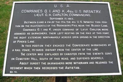
Companies G. I. and K., 4th U.S. Infantry.
Lieut. C.H. Carlton, Commanding.
September 17, 1862.
Between 3 and 4 p.m., of the 17th, the 4th U.S. Infantry took position on the right (north) of the Boonsboro Pike, near the Bloody Lane.
Companies G. I. and K. under command of Lieut. Carlton, were advanced as skirmishers, their left resting on the pike at this point. The right extending northwardly across open ground in the direction of Piper's Lane.
In this position they engaged the Confederate skirmishers at a rail fence, 75 yards distant from the center of the line.
The center was enfiladed by canister from the enemy's guns on Cemetery Hill, south of this road, and suffered severely.
About sunset the skirmishers were withdrawn and rejoined the regiment which then recrossed the Antietam.
Erected by Antietam Battlefield Board. (Marker Number 78.)
Topics and series. This historical marker is listed in this topic list: War, US Civil. In addition, it is included in the Antietam Campaign War Department Markers series list. A significant historical month for this entry is September 1826.
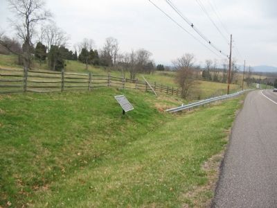
Location. 39° 27.68′ N, 77° 44.383′ W. Marker is in Sharpsburg, Maryland, in Washington County. Marker is on Boonsboro / Shepherdstown Pike (State Highway 34), on the right when traveling west. Located at the entrance to the parking lot for the Antietam National Cemetery. Touch for map. Marker is in this post office area: Sharpsburg MD 21782, United States of America. Touch for directions.
Other nearby markers. At least 8 other markers are within walking distance of this marker. Battle of Antietam, September 17, 1862 (within shouting distance of this marker); 1862 Antietam Campaign (within shouting distance of this marker); Jones' Battalion, Reserve Artillery (about 500 feet away, measured in a direct line); Reserve Artillery (about 500 feet away); Squires’ Battery, 1st Company Washington Artillery of New Orleans (about 700 feet away); Unknown Union Soldiers of the Irish Brigade (about 700 feet away); Not For Themselves, But For Their Country (about 700 feet away); Antietam National Cemetery (about 700 feet away). Touch for a list and map of all markers in Sharpsburg.
Also see . . .
1. Antietam Battlefield. National Park Service site. (Submitted on April 13, 2008, by Craig Swain of Leesburg, Virginia.)
2. 4th U.S. Infantry Regiment, 1st Brigade, 2nd Division, V Corps. Lieutenant Carlton was a 1859 graduate of West Point. He later commanded the 89th Ohio Infantry Regiment in the Western Theater. He had a long post war career, eventually retiring with the rank of Brigadier General. (Submitted on April 13, 2008, by Craig Swain of Leesburg, Virginia.)

Photographed By Craig Swain, April 6, 2008
3. 4th Infantry Skirmish Line
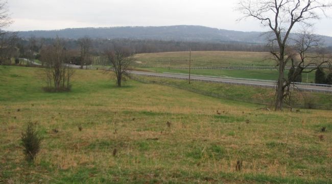
From the high ground north of the Cemetery parking lot, looking back to the southeast. The modern Boonsboro Pike runs across the frame. The old road bed is a few yards to the south of that. The skirmishers from three companies of the 4th U.S. Infantry advanced directly up the slopes here. With their left flank (along the road) refused, the skirmishers confronted Confederate artillery batteries positioned on the high ground, not far from the where this photo was taken.
Credits. This page was last revised on September 29, 2017. It was originally submitted on April 13, 2008, by Craig Swain of Leesburg, Virginia. This page has been viewed 959 times since then and 10 times this year. Photos: 1, 2, 3. submitted on April 13, 2008, by Craig Swain of Leesburg, Virginia.

