Anoka in Anoka County, Minnesota — The American Midwest (Upper Plains)
Logbooms Meet Sawmills
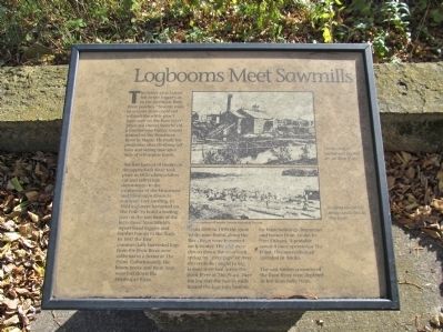
The white pine forests fell to the logger's ax in the northern Rum River pineries, "Seventy mills in seventy years could not exhaust the white pine I have seen on the Rum River" predicted Daniel Stanchfield, a lumber-wise timber cruiser trained on the Penobscot River in Maine. He made his prediction after climbing tall trees and seeing mile after mile of white pine forest.
The first harvest of timber on the upper Rum River took place in 1820 when soldiers cut and rafted logs downstream to the confluence of the Minnesota and Mississippi Rivers to construct Fort Snelling. In 1844 logs were harvested on The Point to build a trading post on the east bank of the Rum River. Stanchfield's report lured loggers and lumber barons to the Rum. In 1847 the first commercially harvested logs from the Rum River were collected in a boom at The Point. Unfortunately, the boom broke and those logs were lost down the Mississippi River.
From 1850 to 1890 the great white pine forests along the Rum River were harvested each winter. The logs were driven down the river each spring by "river pigs" or river drivers to be caught in log booms stretched across the Rum River at The Point. Here the log met the saw as mills turned the logs into lumber for farm buildings, businesses and homes from Anoka to New Orleans. A portable sawmill once operated at The Point. Five sawmills once operated in Anoka.
The vast timber resources of the Rum River were depleted in less than forty years.
Topics. This historical marker is listed in these topic lists: Industry & Commerce • Waterways & Vessels. A significant historical year for this entry is 1820.
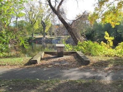
Location. 45° 11.476′ N, 93° 23.437′ W. Marker is in Anoka, Minnesota, in Anoka County. Marker can be reached from South Ferry Road, 0.3 miles east of South Ferry Street (U.S. 169). Marker is in Peninsula Point Park / The Point. Touch for map. Marker is at or near this postal address: 1460 South Ferry Parkway, Anoka MN 55303, United States of America. Touch for directions.
Other nearby markers. At least 8 other markers are within walking distance of this marker. Where Cultures Meet (within shouting distance of this marker); Fireman's Grove (within shouting distance of this marker); River Highways (about 300 feet away, measured in a direct line); Highway of Exploration (about 400 feet away); Circle of Life (about 400 feet away); Where Land and Water Meet (about 500 feet away); Bridging the Mississippi (about 500 feet away); Who Lived Here / Neighborhood Names / Building a Community (about 700 feet away). Touch for a list and map of all markers in Anoka.
More about this marker. photo captions:
• The Washburn lumber mill located on the Rum River.
• Logging operations being conducted at The Point.
• Photos courtesy of Anoka County Historical Society.
Also see . . .
1. Log boom. Wikipedia entry. "A log boom is a barrier placed in a river, designed to collect and or contain floating logs timbered from nearby forests..." (Submitted on December 27, 2013.)
2. The History of the Upper Midwest. Pioneering the Upper Midwest. The Pineries. "As forests to the east gave way, the industry moved west. In 1865, Michigan lead all the states in timber production; by 1890, Minneapolis was the premier lumber market in the world..." (Submitted on December 27, 2013.)
Credits. This page was last revised on June 16, 2016. It was originally submitted on December 27, 2013, by Keith L of Wisconsin Rapids, Wisconsin. This page has been viewed 877 times since then and 25 times this year. Photos: 1, 2, 3. submitted on December 27, 2013, by Keith L of Wisconsin Rapids, Wisconsin.


