Troy Hill in Pittsburgh in Allegheny County, Pennsylvania — The American Northeast (Mid-Atlantic)
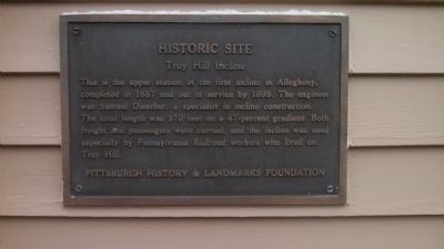
Troy Hill Incline
— Historic Site —
This is the upper station of the first incline in Allegheny, completed in 1887 and out of service by 1898. The engineer was Samuel Diescher, a specialist in incline construction. The total length was 370 feet on a 47-percent gradient. Both freight and passengers were carried, and the incline was used especially by Pennsylvania Railroad workers who lived on Troy Hill.
Erected by Pittsburgh History and Landmarks Foundation.
Topics and series. This historical marker is listed in these topic lists: Industry & Commerce • Railroads & Streetcars. In addition, it is included in the Pennsylvania, Pittsburgh History and Landmarks Foundation series list. A significant historical year for this entry is 1887.
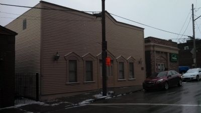
Location. 40° 27.872′ N, 79° 58.916′ W. Marker is in Pittsburgh, Pennsylvania, in Allegheny County. It is in Troy Hill. Marker is at the intersection of Lowrie Street and Froman Street, on the right when traveling east on Lowrie Street. Touch for map. Marker is in this post office area: Pittsburgh PA 15212, United States of America. Touch for directions.
Other nearby markers. At least 8 other markers are within walking distance of this marker. Troy Hill Fire Station #39 (within shouting distance of this marker); 31st Street Bridge (about 700 feet away, measured in a direct line); The Thomas Carlin's Sons Foundry (approx. 0.2 miles away); Herr's Island (approx. 0.3 miles away); St. Nicholas Roman Catholic Croatian Church, North Side (approx. half a mile away); Our Lady of Lourdes Grotto (approx. half a mile away); St. Nicholas Church (approx. half a mile away); Mala Jaska (approx. half a mile away). Touch for a list and map of all markers in Pittsburgh.
Also see . . .
1. Troy Hill Incline article from Wikipedia. (Submitted on December 31, 2013, by Mike Wintermantel of Pittsburgh, Pennsylvania.)
2. Pittsburgh History and Landmarks Foundation. (Submitted on December 31, 2013, by Mike Wintermantel of Pittsburgh, Pennsylvania.)
Credits. This page was last revised on February 2, 2023. It was originally submitted on December 31, 2013, by Mike Wintermantel of Pittsburgh, Pennsylvania. This page has been viewed 621 times since then and 17 times this year. Photos: 1, 2. submitted on December 31, 2013, by Mike Wintermantel of Pittsburgh, Pennsylvania.

