Derry-Londonderry in Derry And Strabane, Northern Ireland, United Kingdom — Northwestern Europe (the British Isles)
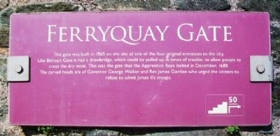
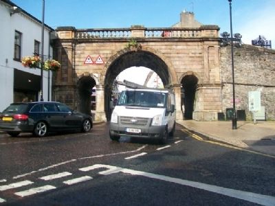
Ferryquay Gate
Topics. This historical marker is listed in these topic lists: Disasters • Forts and Castles • Man-Made Features • Settlements & Settlers. A significant historical month for this entry is December 1688.
Location. 54° 59.678′ N, 7° 19.199′ W. Marker is in Derry-Londonderry, Northern Ireland, in Derry And Strabane. Marker is on Carlisle Road / Ferryquay Street, on the right when traveling north. The marker is on the City Wall, adjacent to Ferryquay Gate, and north opposite the Foyleside Shopping Centre. Touch for map. Marker is in this post office area: Derry-Londonderry, Northern Ireland BT48 6XY, United Kingdom. Touch for directions.
Other nearby markers. At least 8 other markers are within walking distance of this marker. The Walled City (here, next to this marker); a different marker also named Ferryquay Gate (a few steps from this marker); Demi-culverin Cannon (within shouting distance of this marker); Newgate Bastion (within shouting distance of this marker); Artillery Bastion (about 90 meters away, measured in a direct line); Newmarket Street (about 90 meters away); a different marker also named Demi-culverin Cannon (about 90 meters away); New Gate (about 120 meters away). Touch for a list and map of all markers in Derry-Londonderry.
Also see . . . The Siege of Derry (1689). (Submitted on January 4, 2014, by William Fischer, Jr. of Scranton, Pennsylvania.)
Credits. This page was last revised on August 27, 2020. It was originally submitted on January 4, 2014, by William Fischer, Jr. of Scranton, Pennsylvania. This page has been viewed 367 times since then and 7 times this year. Photos: 1, 2. submitted on January 4, 2014, by William Fischer, Jr. of Scranton, Pennsylvania.

