Near St. Peter in Nicollet County, Minnesota — The American Midwest (Upper Plains)
The Treaty of Traverse des Sioux
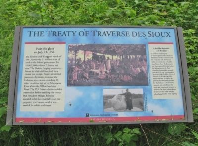
Near this place on July 23, 1851, the Sisseton and Wahpeton bands of the Dakota sold 21 million acres of land to the federal government for $1,665,000—about 7.5 cents per acre. The Dakota, hoping to ensure a future for their children, had little choice but to sign. Besides an annual payment, the treaty promised the Dakota a reservation extending 10 miles on either side of the Minnesota River above the Yellow Medicine River. The U.S. Senate eliminated this reservation before ratifying the treaty. But President Millard Fillmore decided to let the Dakota live on the proposed reservation, until it was needed for white settlement.
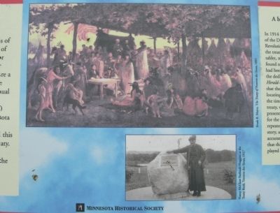
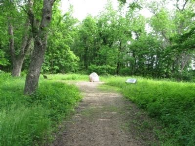
A boulder becomes The Boulder In 1914 the local chapter of the Daughters of the American Revolution (DAR) commemorated the treaty site with this bronze tablet, mounted onto a boulder found near where the document had been signed. Five days before the dedication, the St. Peter Herald enthusiastically reported that the DAR had "succeeded in locating a large boulder, which, at the time of the signing of the treaty, was used to display the presents that had been provided for the Indians." Other writers repeated and embellished the story, and it was soon accepted as accurate. Yet there is no evidence that this or any other boulder played a part in the treaty signing.
Traverse des Sioux
Erected by the Minnesota Historical Society.
Topics and series. This historical marker is listed in this topic list: Native Americans. In addition, it is included in the Former U.S. Presidents: #13 Millard Fillmore, and the Minnesota Historical Society series lists. A significant historical date for this entry is July 23, 1851.
Location. 44° 21.274′ N, 93° 57.354′ W. Marker is near St. Peter, Minnesota, in Nicollet County. Marker can be reached from Old Minnesota Avenue west of Minnesota Avenue (U.S. 169). A small parking lot is just west of the intersection. Touch for map. Marker is in this post office area: Saint Peter MN 56082, United States of America. Touch for directions.
Other nearby markers. At least 8 other markers are within walking distance of this marker. Treaty of Traverse des Sioux Site (here, next to this marker); The Old French Cemetery (within shouting distance of this marker); A River Crossroad (approx. 0.2 miles away); Exploring the River Valley (approx. 0.2 miles away); Fur Trader Louis Provencalle (approx. ¼ mile away); The Rush for Land (approx. 0.3 miles away); Treaty of Traverse Des Sioux (approx. 0.3 miles away); Ministering to the Dakota (approx. 0.4 miles away). Touch for a list and map of all markers in St. Peter.
More about this marker. captions:
• Frank B. Mayer, The Treaty of Traverse des Sioux, 1885
• Nancy McClure Faribault Huggins at the Treaty Rock, Traverse des Sioux, 1927
Also see . . .
1. Treaty of Traverse des Sioux. Wikipedia entry. (Submitted on January 6, 2014.)
2. Traverse des Sioux. Wikipedia entry. (Submitted on January 6, 2014.)
Credits. This page was last revised on August 6, 2021. It was originally submitted on January 6, 2014, by Keith L of Wisconsin Rapids, Wisconsin. This page has been viewed 835 times since then and 34 times this year. Photos: 1, 2, 3, 4. submitted on January 6, 2014, by Keith L of Wisconsin Rapids, Wisconsin.


