Produce and Waterfront in Oakland in Alameda County, California — The American West (Pacific Coastal)
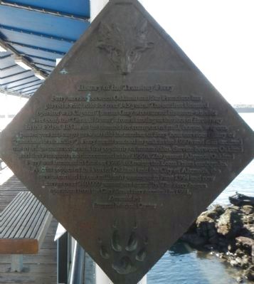
History of the Transbay Ferry
Ferry service between Oakland and San Francisco has played a vital role over 145 years. The earliest licensed operator was Captain Thomas Gray who started his stern-wheeler river boat, the “General Sutter”, from a landing at the foot of Broadway in the Fall of 1851. As the demand for transportation of mail, horses, wagons, passengers and cargo grew, so did the number of ferry boat services (many of “questionable reliability”). Ferry transit reached its peak in the 1930’s and then declined due to bridge construction and the popularity of automobiles. Service between Oakland and San Francisco was discontinued in the 1950’s. The present Alameda/Oakland Ferry was launched in October 1989, following the Loma Prieta earthquake. A joint project of the Port of Oakland and the City of Alameda, the service carried its one millionth passenger in June 1994 and now serves 340,000 passengers annually. The ferry began operations from the Clay Street ferry terminal in 1991.
Donated by
Summit Medical Center
Erected by Port of Oakland.
Topics. This historical marker is listed in this topic list: Waterways & Vessels. A significant historical month for this entry is June 1994.
Location. 37° 47.712′ N, 122° 16.784′ W. Marker is in Oakland , California, in Alameda County. It is in Produce and Waterfront. Marker can be reached from Clay Street near Water Street. Touch for map. Marker is in this post office area: Oakland CA 94607, United States of America. Touch for directions.
Other nearby markers. At least 8 other markers are within walking distance of this marker. Evolution of a Marine Terminal (a few steps from this marker); USS Potomac (a few steps from this marker); Charles P. Howard Terminal (a few steps from this marker); The Port of Oakland (within shouting distance of this marker); Jack London (about 700 feet away, measured in a direct line); Oakland's First Wharf (about 700 feet away); Estuary Industry (about 700 feet away); Live Oak Lodge U.D (about 700 feet away). Touch for a list and map of all markers in Oakland.
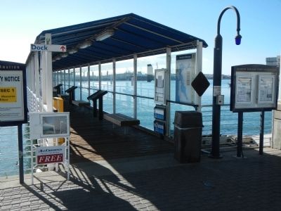
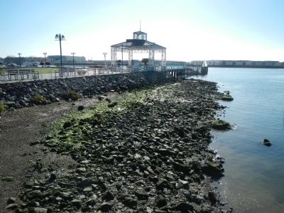
More about this marker. This marker is located at the Oakland Ferry Terminal at the foot of Clay Street in Jack London Square. Jack London Square is closed to vehicular traffic.
Credits. This page was last revised on February 7, 2023. It was originally submitted on January 12, 2014, by Barry Swackhamer of Brentwood, California. This page has been viewed 677 times since then and 25 times this year. Photos: 1, 2, 3. submitted on January 12, 2014, by Barry Swackhamer of Brentwood, California. • Bill Pfingsten was the editor who published this page.


