Near Chatham in Chatham-Kent, Ontario — Central Canada (North America)
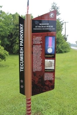
Skirmish at McCrae's House
Wednesday, December 15, 1813
— Tecumseh Parkway —
Inscription.
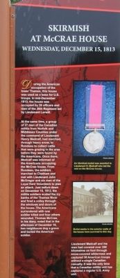
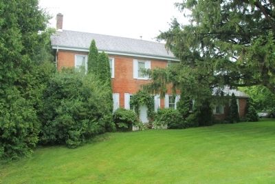
During the American occupation of the lower Thames, this house was used as a base for U.S. troops. In mid-December 1813, the house was occupied by 39 officers and men of the 26th Regiment led by Lieutenant Larwill.
At the same time, a group of 27 men of the Canadian militia from Norfolk and Middlesex Counties under the command of Lieutenant Henry Medcalf, had marched, through heavy snow, to Rondeau to collect cattle that were grazing in the area before they were found by the Americans. Once there, Medcalf was informed of the Americans occupying the McCrae house. From Rondeau, the soldiers marched to Chatham and met with Lieutenant John McGregor and six men of the Loyal Kent Volunteers to plan an attack. Just before dawn on December 15, 1813, the militia soldiers scaled the icy banks of the Thames River and fired a volley through the windows and doors of the house.The Americans surrendered with one soldier killed and four others wounded. Thomas McCrae, in his diary, noted that in the afternoon of December 16, two neighbours dug a grave and buried the American soldier.
Lieutenant Medcalf and his men had covered over 350 kilometres on foot through snow-covered wilderness and captured 38 American troops without a single Canadian casualty. It was the only time that a Canadian militia unit has captured a regular U.S. Army unit.
Erected by Tecumseh Parkway.
Topics. This historical marker is listed in this topic list: War of 1812. A significant historical month for this entry is December 1865.
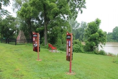
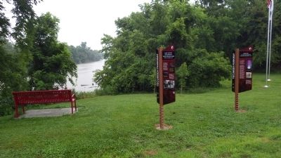
Location. 42° 22.91′ N, 82° 14.988′ W. Marker is near Chatham, Ontario, in Chatham-Kent. Marker is on Riverview Line (County Route 36) close to County Route 36, on the left when traveling east. This historical marker is located west of Chatham, at a small roadside park, on the north side of the road, close to another Tecumseh Parkway marker, and very near the Thames River. Touch for map. Marker is at or near this postal address: 7391 Riverview Line, Chatham ON N7M 5J5, Canada. Touch for directions.
Other nearby markers. At least 8 other markers are within 6 kilometers of this marker, measured as the crow flies. First Nations Encampment: Thomas McCrae Farm (here, next to this marker); a different marker also named Skirmish at McCrae's House (a few steps from this marker); British Army River Crossing to Dolsen's Landing (approx. 1.9 kilometers away); Casualties of the Skirmish (approx. 6 kilometers away); Skirmish at the Forks (approx. 6 kilometers away); a different marker also named Skirmish at the Forks (approx. 6 kilometers away); British Encampment: Forks of the Thames (approx. 6 kilometers away); The Forks (approx. 6 kilometers away). Touch for a list and map of all markers in Chatham.
Also see . . .
1. Tecumseh Parkway | Longwoods Barn Quilt Trail. This is a link to an article regarding the Tecumseh Parkway that is provided by the Longwoods Barn Quilt Trail website. (Submitted on January 17, 2014, by Dale K. Benington of Toledo, Ohio.)
2. Tecumseh Parkway officially launched - Chatham Daily News. This is a link to a news article regarding the Tecumseh Parkway provided by the Chatham Daily News. (Submitted on January 17, 2014, by Dale K. Benington of Toledo, Ohio.)
Credits. This page was last revised on September 27, 2019. It was originally submitted on January 16, 2014, by Dale K. Benington of Toledo, Ohio. This page has been viewed 695 times since then and 13 times this year. Photos: 1, 2, 3, 4, 5, 6. submitted on January 17, 2014, by Dale K. Benington of Toledo, Ohio.
