Near Morton in Renville County, Minnesota — The American Midwest (Upper Plains)
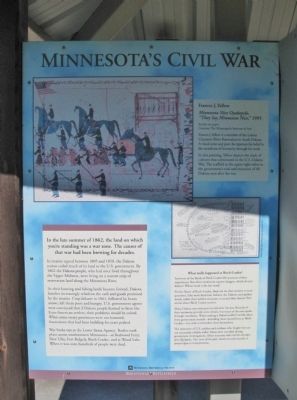
Minnesota's Civil War
In the late summer of 1862, the land on which you're standing was a war zone. The causes of that war had been brewing for decades.
In treaties signed between 1805 and 1858, the Dakota nation ceded much of its land to the U.S. government. By 1862 the Dakota people, who had once lived throughout the Upper Midwest, were living on a narrow strip of reservation land along the Minnesota River.
As their hunting and fishing lands became limited, Dakota families increasingly relied on the cash and goods promised by the treaties. Crop failures in 1861, followed by heavy snows, left them poor and hungry. U.S. government agents were convinced that if Dakota people learned to farm like Euro-American settlers, their problems would be solved. When some treaty provisions were not honored, frustrations that had been building for years peaked.
War broke out at the Lower Sioux Agency. Battles took place across southwestern Minnesota—at Redwood Ferry, New Ulm, Fort Ridgely, Birch Coulee, and at Wood Lake. When it was over, hundreds of people were dead.
What really happened at Birch Coulee?
Survivors of the Battle of Birch Coulee left accounts of their experiences. But when eyewitness reports disagree, which do you believe? Whose word is the last word?
For the Battle of Birch Coulee, there are no clear answers to such questions. Like most American Indians, the Dakota used spoken words, rather than written accounts, to record their history. Few stories about Birch Coulee survive.
Many Dakota men were put on trial after the war. Records of their testimony provided some details, but many of the men spoke through translators. When reading a Dakota soldier's words taken from government records—including those quoted here at Birch Coulee—it is vital to remember these limitations.
The memories of U.S. soldiers and civilians who fought here are not necessarily reliable either. Many were recorded during government investigations. Other accounts were written decades after the battle. Our view of the past, based on such records, is always open to interpretation.
Frances J. Yellow
Minnesota Nice Oyakepelo,
"They Say Minnesota Nice," 1995
Acrylic on paper
Courtesy The Minneapolis Institute of Arts
Francis J. Yellow is a member of the Lakota Cheyenne River Reservation in South Dakota. A visual artist and poet, he expresses his belief in the sacredness of humanity through his work.
In this painting, Yellow depicts the clash of cultures that culminated in the U.S.-Dakota War. The scaffold at the upper right refers to the government's trial and excecution of 40 Dakota men after the war.
Birch Coulee Battlefield
Erected by the Minnesota Historical Society.
Topics and series. This historical marker is listed in these topic lists: Native Americans • Wars, US Indian. In addition, it is included in the Minnesota Historical Society series list. A significant historical year for this entry is 1862.
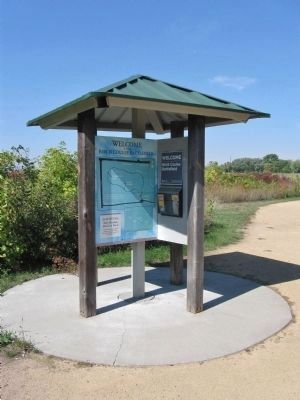
Location. 44° 34.493′ N, 94° 58.503′ W. Marker is near Morton, Minnesota, in Renville County. Marker can be reached from County Road 18, 0.2 miles south of 690th Avenue (County Road 2), on the left when traveling south. Marker is at a kiosk within Birch Coulee Battlefield/State Park. Touch for map. Marker is at or near this postal address: 68634 County Road 18, Morton MN 56270, United States of America. Touch for directions.
Other nearby markers. At least 8 other markers are within walking distance of this marker. The Story of the Land (here, next to this marker); The Battle of Birch Coulee (within shouting distance of this marker); Two Men, One War (about 400 feet away, measured in a direct line); Wrong Place, Wrong Time (about 500 feet away); After the Battle (about 500 feet away); "A Beautiful Place to Encamp" (about 500 feet away); The Battle Ends (about 700 feet away); a different marker also named The Battle of Birch Coulee (about 700 feet away). Touch for a list and map of all markers in Morton.
More about this marker. map caption:
Robert Boyd, Map of Birch Coulee Battlefield, 1925
Also see . . .
1. Birch Coulee Battlefield. Minnesota Historical Society website entry:
"On Sept. 1, a burial detail of 160 to 170 soldiers and civilians was dispatched from Fort Ridgely to bury the remains of settlers who had been killed in the early weeks of the U.S.-Dakota War... During the night, the detail was surrounded by Dakota, who attacked at dawn..." (Submitted on January 19, 2014.)
2. Battle of Birch Coulee. Wikipedia entry:
"Colonel Sibley could hear the sounds of the battle from Fort Ridgely, about sixteen miles away, so he sent out a relief party of 240 men. Colonel McPhail, heading up the relief party, thought he was almost completely surrounded by the Sioux and sent back for more reinforcements. Sibley [himself] returned with more reinforcements..." (Submitted on January 19, 2014.)
3. The Battle of Birch Coulee. MNopedia website entry (Submitted on January 19, 2014.)
4. Battle of Birch Coulee. Minnesota Historical Society website entry (Submitted on January 19, 2014.)
Additional keywords. U.S.-Dakota War of 1862

Photographed By K. Linzmeier, September 25, 2013
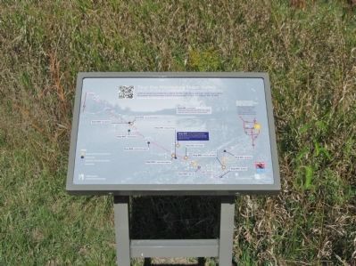
4. Nearby Interpretive Panel
Minnesota River Valley Mobile Tour
Credits. This page was last revised on June 12, 2023. It was originally submitted on January 19, 2014, by Keith L of Wisconsin Rapids, Wisconsin. This page has been viewed 614 times since then and 25 times this year. Photos: 1, 2, 3, 4. submitted on January 19, 2014, by Keith L of Wisconsin Rapids, Wisconsin.


