Mesa Verde National Park in Montezuma County, Colorado — The American Mountains (Southwest)
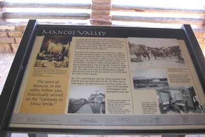
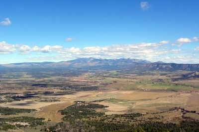
Mancos Valley
As word spread of the Wetherills' "discoveries," tourists flocked to the area. The Rio Grande Southern Railroad, serving Durano, Mancos, and Dolores since 1891, was reliable and the easiest part of the journey to Mesa Verde. The rest of the trip to the cliff dwellings was quite difficult.
Prior to 1914, visitors used the Wetherills' original route from Mancos to Spruce Tree House. The arduous 25-mile trek took an e3ntire day. For the first fifteen miles, visitors traveled by wagon up the canyon to your right. The next ten miles, traveled on foot or on horseback, included a nearly vertical climb to the top of Chapin Mesa. One local guide, Charles B. Kelly, led these expeditions from Mancos as a three-day trip. The cost of the trip (including food, lodging, and horses) was $15.00 per person or $12.50 each for two or more people.
By 1919, automobiles and the newly-graded road behind you cut travel time for the 25-mile trip to three hours. For the first time, travelers could visit a few of the principal archeological sites and return in one-day.
(Left Photo Caption)
John and Al Wetherill in Spruce Tree House. The Wetherill family were Mancos area ranchers who grazed cattle on Mesa Verde. Their explorations were instrumental in the establishment of Mesa Verde as a national park.
— Photo courtesy of National Park Service
(Center Photo Caption)
Passengers arrive in Mancos on the Rio Grande Southern Railroad. Rail travel to southwest Colorado was the most dependable form of transportation prior to 1920.
— Photo courtesy of Denver Public Library–Western History Department
(Upper Right Photo Caption)
Tourists depart for the cliff dwellings of Mesa Verde in 1913.
— Photo courtesy of National Park Service
Middle Right Photo Caption)
The Wetherill brothers popularized the cliff dwellings in the 1890s. Their home, the Alamo Ranch, housed an extensive array of artifacts colected from the cliff dwellings.
— Photo courtesy of National Park Service
(Lower Right Photo Caption)
From 1906 to 1920, Mesa Verde National Park headquarters was located in Mancos.
— Photo courtesy of Denver Public Library–Western History Department
Erected by National Park Service.
Topics. This historical marker is listed in these topic lists: Industry & Commerce • Roads & Vehicles. A significant historical year for this entry is 1891.
Location. 37° 18.268′ N, 108° 24.619′
W. Marker is in Mesa Verde National Park, Colorado, in Montezuma County. Marker can be reached from State Highway 10, 0.4 miles north of Moorefield Campground Road, on the left when traveling south. Marker is located at the Mancos Valley Overlook in Mesa Verde National Park. Touch for map. Marker is in this post office area: Mesa Verde National Park CO 81330, United States of America. Touch for directions.
Other nearby markers. At least 8 other markers are within 5 miles of this marker, measured as the crow flies. Knife Edge... (approx. 1.8 miles away); Montezuma Valley (approx. 1.8 miles away); Southwest Survival (approx. 3.8 miles away); Mesa Verde Country (approx. 3.8 miles away); Four Corners (approx. 3.8 miles away); Cortez (approx. 3.8 miles away); Natural Seep Springs (approx. 4.4 miles away); A Monument to Time (approx. 4.4 miles away). Touch for a list and map of all markers in Mesa Verde National Park.
Credits. This page was last revised on June 16, 2016. It was originally submitted on January 31, 2014, by Duane Hall of Abilene, Texas. This page has been viewed 569 times since then and 21 times this year. Photos: 1, 2. submitted on January 31, 2014, by Duane Hall of Abilene, Texas.
Editor’s want-list for this marker. Photo with wide-view of marker and surroundings. • Can you help?

