Mesa Verde National Park in Montezuma County, Colorado — The American Mountains (Southwest)
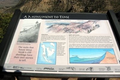
A Monument to Time
Deposition
During the late Cretasceous period (about 90 million years ago) much of North America, including southwest Colorado and the present Rocky Mountains, was covered by a shallow inland sea.
Thousands of feet of marine and shoreline sediments were deposited and now form the rocks of Mesa Verde: shale, sandstone, coal, and siltstone.
Uplift and Erosion
Within the last 65 million years, the Colorado Plateau and Rocky Mountains were formed by a series of uplifts that gradually raised the land thousand of feet above sea level. Erosion probably kept pace with the uplift as streams flowed south and west from the rising La Plata and San Juan Mountains. These ancient streams cut deep canyons across gentle slopes of Mesa Verde dissecting it into the smaller, fingerlike mesas on the southern end of the park.
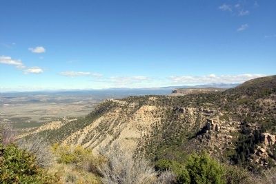
Over millions of years the Mesa Verde formations were raised almost 8,000 feet and gently tilted to the south. These same sedimentary rocks eroded off the uplifted mountains, leaving a 1,500 foot escarpment between Mesa Verde and the La Plata Mountains.
(Left Drawing Caption)
Erosion causes natural indentations which were enlarged by Ancestral Puebloans and used as hand-and-toe-hold trails.
— Illustration by Krista Harris, Interpretive Design
Erected by National Park Service.
Topics. This historical marker is listed in this topic list: Environment.
Location. 37° 16.595′ N, 108° 28.978′ W. Marker is in Mesa Verde National Park, Colorado, in Montezuma County. Marker can be reached from State Highway 10, 3 miles west of Moccasin Mesa Road, on the right when traveling west. Marker is located at the Geologic Overlook in Mesa Verde National Park. Touch for map. Marker is in this post office area: Mesa Verde National Park CO 81330, United States of America. Touch for directions.
Other nearby markers. At least 8 other markers are within 5 miles of this marker, measured as the crow flies. Natural Seep Springs (about 400 feet away, measured in a direct line); Montezuma Valley (approx. 2.7 miles away); Knife Edge... (approx. 2.7 miles away); Far View Reservoir (approx. 2.8 miles away); Prehistoric Mesa Verde Reservoirs (approx. 2.8 miles away); Mancos Valley (approx. 4.4 miles away); Water Technology (approx. 5.1 miles away); Greening the Valley (approx. 5.1 miles away). Touch for a list and map of all markers in Mesa Verde National Park.
Credits. This page was last revised on June 16, 2016. It was originally submitted on January 31, 2014, by Duane Hall of Abilene, Texas. This page has been viewed 544 times since then and 11 times this year. Photos: 1, 2. submitted on January 31, 2014, by Duane Hall of Abilene, Texas.
Editor’s want-list for this marker. Photo with wide-view of marker. • Can you help?

