Jackson in Amador County, California — The American West (Pacific Coastal)
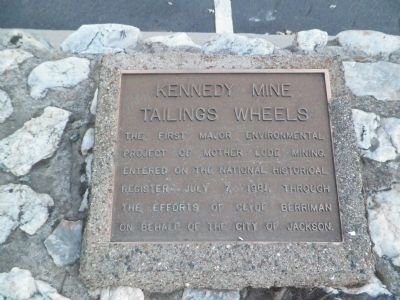
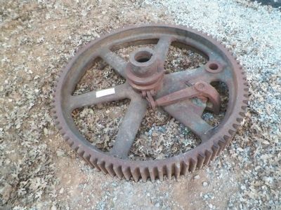
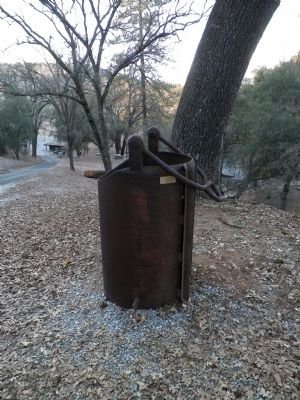
Kennedy Mine Tailings Wheels
Topics. This historical marker is listed in this topic list: Industry & Commerce. A significant historical date for this entry is July 7, 1945.
Location. 38° 21.809′ N, 120° 46.542′ W. Marker is in Jackson, California, in Amador County. Marker is on North Main Street / Jackson Gate Road, one mile north of Carson Pass Highway (California Route 88). Coming from the north on CA-49 or from the west on CA-88, upon reaching the town of Jackson, turn left and immediately left again (doubling back on yourself) onto North Main. Proceed for 1 mile and the Kennedy Mine Tailing Wheels Park will be on your right. Somewhere in the vicinity of the park the name of the road changes from to Jackson Gate Road. Touch for map. Marker is in this post office area: Jackson CA 95642, United States of America. Touch for directions.
Other nearby markers. At least 8 other markers are within walking distance of this marker. Kennedy Mine (about 300 feet away, measured in a direct line); Massa (Tunnel) Adit (about 500 feet away); A. Chichizola Store (approx. ¼ mile away); Kennedy Mine Headframe (approx. 0.4 miles away); Kennedy Mining and Milling Company (approx. 0.4 miles away); Archimandrite Sebastian Dabovich (approx. half a mile away); St. Sava Serbian Orthodox Church (approx. half a mile away); Amador County Veterans' Memorial (approx. 0.6 miles away). Touch for a list and map of all markers in Jackson.
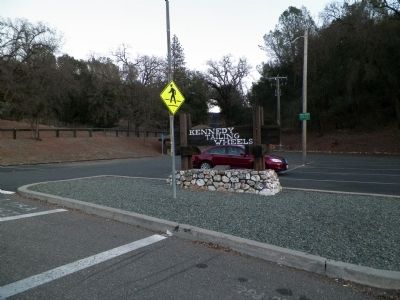
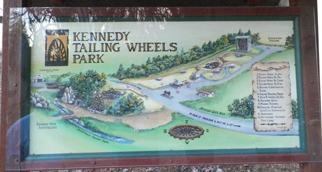
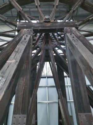
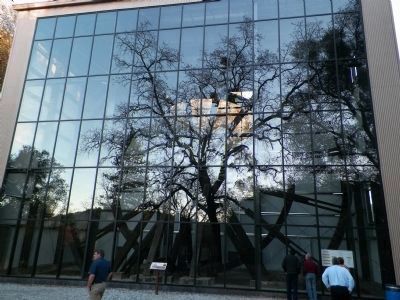
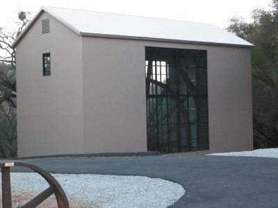
More about this marker. The marker is under the sign at the entrance to the park's parking lot. The informational kiosk is at the far end of the parking lot. You can drive up the hill to another small lot with an overlook of the impoundment dam. The #4 wheel is there in a protective building. The #3 wheel is just below and is wrecked.
Directly across N. Main/Jackson Gate Rd. from the parking lot is a gravel trail to the top of a small hill, the #1 and #2 wheels are there. The #2 wheel is also a wreck.
There is a gravel drive and parking area a couple hundred feet back down N. Main from which you can walk to the #1 wheel and it's informational sign.
Also see . . .
1. The Kennedy Gold Mine. The Kennedy Mine, famous for being one of the deepest gold mines in the world (at 5912 feet), demonstrates how gold changed an entire way of life in California. (Submitted on February 3, 2014, by James King of San Miguel, California.)
2. Kennedy Tailing Wheels. The monstrous, fifty-eight foot diameter Kennedy Tailing Wheels are a one-of-a-kind creation. Although not built during the Gold Rush, these huge wooden wheels were a direct result of a Gold Rush event and are probably the most remembered artifacts of any visit to Jackson today. (Submitted on February 3, 2014, by James King of San Miguel, California.)
Photographed By James King, January 25, 2014
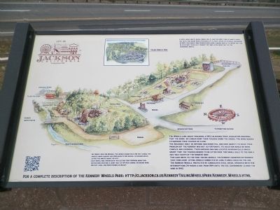
4. Kiosk - A Mine Waste Impound Project
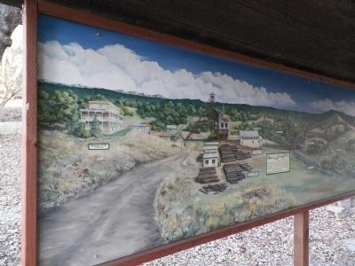
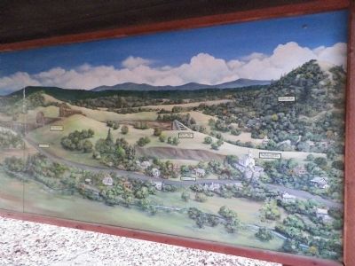
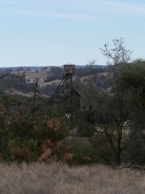
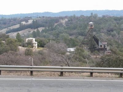
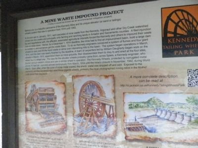
Behind you is a beautiful panorama of the Kennedy Mine and its unique elevator (or sand or tailings) wheels system that was in operation from 1914 until 1942.
A 20-inch rain in January, 1911, sent cascades of mine waste from the Kennedy, Argonaut and other Dry Creek watershed mines into the creeks and principally onto farming and ranching lands in Amador and Sacramento counties. A filed injunction by, and negotiations with, the affected, associated agricultural interests forced the Kennedy and others to impound their waste rock or close down. Hence, by a December 1, 1914 deadline, the mine had to find an impoundment basin, build a large dam to contain it, and somehow get the waste there. To do so Kennedy engineers conceived a system of flumes and four giant wheels to carry and lift the liquid waste or slime over intervening hills to the basin. The system began operations in March, 1914, and the dam was nearly finished by the deadline. A team of carpenters led by William Daugherty began work on the wheels in March, 1913, assembled them on mine grounds, then disassembled them to dray to and erect at the four sites, wheel four to wheel one. The idea for the elevator wheels probably came from James Spiers, a Kennedy engineer, who toured various western mines and saw a similar wheel in operation. The Kennedy Wheels, protected by corrugated metal sheds 50 feet tall, operated almost continuously from March, 1914 until the mine's closure in November, 1942, during World War II. Soon after, when the price of scrap metal soared, the sheds' metal was stripped off and sold. Exposed to the elements and the wondrous eye were these gigantic wheels, probably the most photographed mining relics in the Mother Lode since their exposure.
Photographed By James King, January 25, 2014
9. Tailings Wheel #1 Information Sign
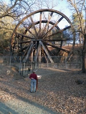
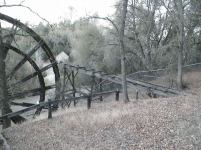
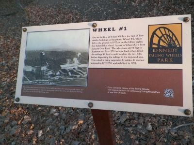
You are looking at Wheel #1. It is the first of four similar buildings in the photo. Wheel #2, which fell to the ground in 1970, is on the hilltop eighty feet behind this wheel. Access to Wheel #2 is from Jackson Gate Road. The wheels are all 58 feet in diameter and have 208 buckets. Each wheel lifted the tailings 42 feet in order to clear the two hills before depositing the tailings in the impound area. This wheel is being supported by cables. It was last restored in 1971-1973 and stabilized in 1995.
This tailing wheel system was built in 1914 to fulfill conditions of an agreement with county and valley agricultural interests to impound mining waste rather than allow it to flow onto farming lands below in the Dry Creek drainage area.
This tailing wheel system was built in 1914 to fulfill conditions of an agreement with county and valley agricultural interests to impound mining waste rather than allow it to flow onto farming lands below in the Dry Creek drainage area.
Photographed By James King, January 25, 2014
11. Tailings Wheel #2 Information Sign
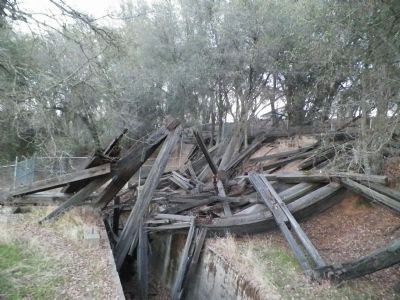
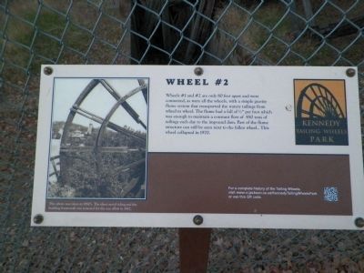
Wheels #1 and #2 are only 80 feet apart and were connected, as were all the wheels, with a simple gravity flume system that transported the watery tailings from wheel to wheel. The flume had a fall of 1/2" per foot which was enough to maintain a constant flow of 850 tons of tailings each day to the impound dam. Part of the flume structure can still be seen next to the fallen wheel. This wheel collapsed in 1970.
This photo was taken in 1950's. The sheet metal siding and the building framework was removed for the war effort in 1942.
This photo was taken in 1950's. The sheet metal siding and the building framework was removed for the war effort in 1942.
Photographed By James King, January 25, 2014
15. Tailings Wheel #3 Information Sign
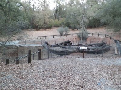
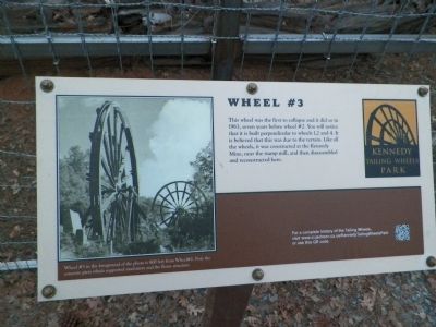
This wheel was the first to collapse and it did so in 1963, seven years before wheel #2. You will notice that it is built perpendicular to wheels 1, 2 & 4. It is believed that this was due to the terrain. Like all the wheels, it was constructed at the Kennedy Mine, near the stamp mill, and then disassembled and reconstructed here.
Wheel #3 in the foreground of the photo is 800 feet from Wheel #2. Note the concrete piers which supported machinery and the flume structure.
Wheel #3 in the foreground of the photo is 800 feet from Wheel #2. Note the concrete piers which supported machinery and the flume structure.
Photographed By James King, January 25, 2014
19. Tailings Wheel #4 Information Sign
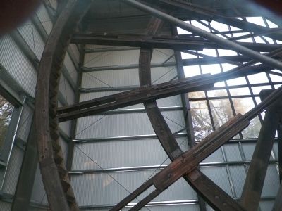
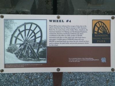
Wheel #4 has best withstood the ravages of time due to the efforts of the first Save the Wheel attempt in 1971. Excelsior Parlor No. 31, Native Sons of the Golden West, of Jackson, the American Institute of Mining and Metallurgical Engineers, community donations and Evelyn Garbarini and others contributed to this effort. In 2001, another $150,000 restoration took place on this wheel only with funds from a state grant. A similar grant of $596,000 along with over $80,000 in matching funds (see donor list near wheel) has been used to enhance the park facility and provide permanent shelter for this wheel.
Wheel #4 bows to time and weather. In 1971-73, it was straightened and strengthened to keep it from falling.
Wheel #4 bows to time and weather. In 1971-73, it was straightened and strengthened to keep it from falling.
Photographed By James King, January 25, 2014
21. The Impoundment Dam Information Sign
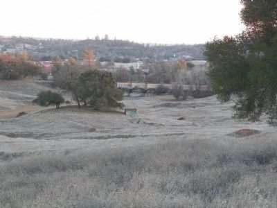
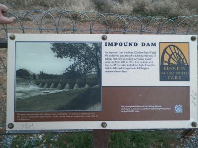
An impound dam was built 1000 feet from Wheel #4 and it was constructed to hold the 850 tons of tailings that were deposited in "Indian Gulch" every day from 1914 to 1933. The multiple arch dam is 455 feet wide and 44 feet high. It was first built in 1914 and brought to its full height a number of years later.
This photo shows the dam after millions of tons of tailings had been removed beginning in 1933. The removed tailings were reprocessed in a nearby cyanide plant and produced an average of $2.25 in gold per ton.
This photo shows the dam after millions of tons of tailings had been removed beginning in 1933. The removed tailings were reprocessed in a nearby cyanide plant and produced an average of $2.25 in gold per ton.
Photographed By James King, January 25, 2014
27. Kiosk - The (Jackson) Gate
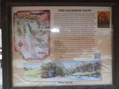
The Gate it was. A camp amid placer and tunnel claims and as yet undiscovered deep quartz veins, on the left bank of a minor creek fork in the foothills of the Sierra. Miners bestowed the name on the narrow cleft - wider now - in a rock ledge which once thwarted the fork. Many miners stayed at The Gate to make surface, tunnel and quartz claims and created the Jackson Gate Mining District in 1854. That basic document contains names of claimants like Gibbons, Andrew Kennedy, Agostino Chichizola, Antonio Massa, Marie Suize Pantalons and others who would stay to create more history. Besides a "gate" for a creek, the camp was a transportation "gate," also. Stage traffic in the early 1850s from the west mainly took the Gate route past the Oneida Mine, down Oneida valley into Jackson, when it was the seat of Calaveras County. Perhaps the real heyday of Jackson Gate occurred from c1890 to 1942 when both the Argonaut and Kennedy Mines finally hit paying ore, and mining boarding houses sprouted on mine property and also adjacently in Jackson Gate and Kennedy Flat. Most were operated by Italian proprietors like Casazza, Giurlani and Buscaglia. When the mines closed during World War II, the Giurlanis and the Buscaglias converted their miners' boarding houses into family-style restaurants. The Giurlanis unto the fifth generation still operate the popular Teresa's Restaurant. Today, Jackson Gate residents see their former village as a "gate" to some of the county's most historic spots, including Chichizola store, Teresa's (part of which dates from the 1860s), the Kennedy Mine and grounds, the St. Sava Serbian Orthodox Church, Jackson's historic cemeteries, and, of course, this Kennedy Tailing Wheels Park.
Credits. This page was last revised on September 1, 2020. It was originally submitted on February 2, 2014, by James King of San Miguel, California. This page has been viewed 847 times since then and 45 times this year. Photos: 1, 2, 3, 4. submitted on February 2, 2014, by James King of San Miguel, California. 5. submitted on March 2, 2014, by James King of San Miguel, California. 6, 7, 8, 9, 10, 11, 12, 13, 14, 15, 16, 17, 18, 19, 20, 21, 22, 23, 24, 25, 26. submitted on February 3, 2014, by James King of San Miguel, California. 27. submitted on February 2, 2014, by James King of San Miguel, California. • Syd Whittle was the editor who published this page.
