Atlas District in Northeast Washington in Washington, District of Columbia — The American Northeast (Mid-Atlantic)
Brickyards to Buildings
Hub, Home, Heart
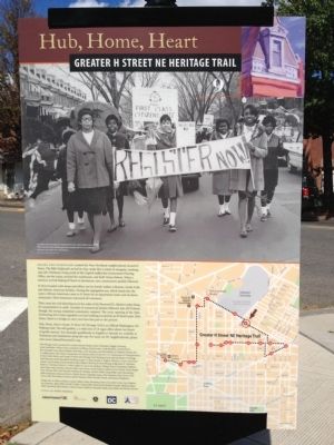
— Greater H Street NE Heritage Trail —
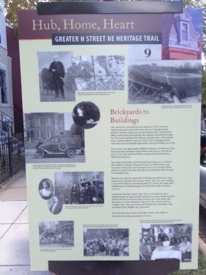
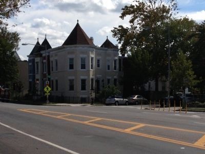
The Trinidad neighborhood, named for W.W. Corcoran's original estate, got its start in the 1890s after the Washington Brick Machine Company used up the clay here making bricks. With H Street filling in with houses and businesses, the company sold land for housing lots. The sturdy rowhouses that followed originally sold to white families, many of whom walked to work on H Street. Once Washington Brick closed, the American Baseball League built a short-lived ballpark on its site.
The streets to your right predate Trinidad's rowhouses. Around 1900 John Fisher operated a wholesale candy business in his home at 1008 Florida Avenue. Sons John and Edward Fisher continued the family business, which lasted until 1941.
The Arthur Nock family owned the large house nearby at 1001 K Street. After hardware salesman Arthur died in 1930, his widow Louise took in boarders. During the Great Depression (1929-1941), hungry drifters alerted by a mark on the back door left by an earlier hobo, knew to knock for something to eat.
Between 1945 and 1960, many white Washingtonians left the city. Some wanted newer, suburban-style housing. Others, after 1954, were unwilling to send their children to newly desegregated DC schools. Like many older neighborhoods, Trinidad changed very quickly from white to African American.
Construction foreman Charles "Bob" Martin and family moved to Trinidad Avenue in 1948, and railroad dining car steward Joseph Strowder and his wife Korea arrived on Queen Street in 1950. They joined other newcomers to create community, leading DC's first African American Campfire Girls, a Boy Scout troop, the Trinidad Drum and Bugle Corps, and Mount Olivet Heights Civic Association.
To reach Sign 10, proceed on Florida Avenue, turn right on 13th Street, and then turn left on H Street.
Erected 2012 by Cultural Tourism DC. (Marker Number 9.)
Topics and series. This historical marker is listed in these topic lists: African Americans • Industry & Commerce • Notable Places • Sports. In addition, it is included in the Greater H Street Heritage Trail series list. A significant historical year for this entry is 1900.
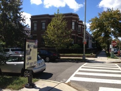
Location. 38° 54.217′ N, 76° 59.555′ W. Marker is in Northeast Washington in Washington, District of Columbia. It is in the Atlas District. Marker is at the intersection of Florida Avenue Northeast and 10th Street Northeast, on the right when traveling east on Florida Avenue Northeast. Touch for map. Marker is at or near this postal address: 1035 10th Street Northeast, Washington DC 20002, United States of America. Touch for directions.
Other nearby markers. At least 8 other markers are within walking distance of this marker. Education for All (about 700 feet away, measured in a direct line); Leonard M. Elstad (about 700 feet away); Holyland Spiritual Temple (about 800 feet away); Laurent Clerc (approx. 0.2 miles away); Thomas Hopkins Gallaudet (approx. 0.2 miles away); Chapel Hall (approx. 0.2 miles away); Edward Miner Gallaudet (approx. 0.2 miles away); Site of the Rose Cottage (approx. 0.2 miles away). Touch for a list and map of all markers in Northeast Washington.
Credits. This page was last revised on January 30, 2023. It was originally submitted on October 6, 2012, by Craig Swain of Leesburg, Virginia. This page has been viewed 912 times since then and 42 times this year. Last updated on November 26, 2021, by Carl Gordon Moore Jr. of North East, Maryland. Photos: 1, 2, 3, 4. submitted on October 6, 2012, by Craig Swain of Leesburg, Virginia. • Devry Becker Jones was the editor who published this page.


