Stinnett in Hutchinson County, Texas — The American South (West South Central)
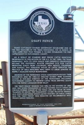
Drift Fence
Famed cattleman Charles Goodnight established one of the first ranches in the Texas Panhandle, the JA ranch, in 1876. Later that year Thomas S. Bugbee established the first cattle ranch in Hutchinson County.
As a result of soaring beef prices cattle ranching proliferated in this region of the U.S. in the 1880s. The Texas Panhandle, with its open range and expansive grasslands became the preferred winter grazing site for cattle migrating south from Colorado, New Mexico, Oklahoma and Kansas. This seasonal influx of cattle disrupted the practice of area ranchers who went to great lengths to respect adjacent ranch boundaries.
Members of the Panhandle Stock Association pooled their resources and in 1882-85 erected barbed wire barriers along a 200-mile stretch of the Panhandle including Hutchinson County to prevent cattle from drifting south into the fertile Canadian River valley.
The "Drift Fence" worked too well in the winters of 1886 and 1887 when thousands of cattle moving south ahead of strong storms stalled at the fence line and froze or were trampled to death. The staggering losses prompted federal and state legislation which limited fencing on public lands and the "Drift Fence" was removed or incorporated into private ranch fencing.
Sesquicentennial of Texas Statehood 1845-1995
Marker is property of the State of Texas
Erected 1995 by Texas Historical Commission. (Marker Number 1286.)
Topics. This historical marker is listed in these topic lists: Animals • Settlements & Settlers. A significant historical year for this entry is 1876.
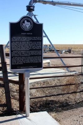
Location. 35° 57.037′ N, 101° 23.939′ W. Marker is in Stinnett, Texas, in Hutchinson County. Marker is at the intersection of State Highway 207 and County Road H, on the right when traveling south on State Highway 207. Touch for map. Marker is in this post office area: Stinnett TX 79083, United States of America. Touch for directions.
Other nearby markers. At least 8 other markers are within 13 miles of this marker, measured as the crow flies. First Battle of Adobe Walls (approx. 4.9 miles away); Isaac McCormick Cottage (approx. 8.8 miles away); Hutchinson County Courthouse (approx. 8.9 miles away); a different marker also named Drift Fence (approx. 10.7 miles away); Holt School (approx. 10.7 miles away); Holt Cemetery (approx. 10.7 miles away); Gulf Dial #1 Oil Well (approx. 11.1 miles away); Site of Old Zulu Stockade (approx. 12.7 miles away). Touch for a list and map of all markers in Stinnett.
Credits. This page was last revised on July 15, 2022. It was originally submitted on February 17, 2014, by Marvin Seibert of Ketchikan, Alaska. This page has been viewed 838 times since then and 38 times this year. Last updated on July 11, 2022, by Joe Lotz of Denton, Texas. Photos: 1, 2. submitted on February 17, 2014, by Marvin Seibert of Ketchikan, Alaska. • J. Makali Bruton was the editor who published this page.

