College Park in Prince George's County, Maryland — The American Northeast (Mid-Atlantic)
"From Stagecoach to Streetcar to Subway: A College Town Emerges"
City of College Park
— Anacostia Trails Heritage Area —
Inscription.
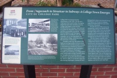
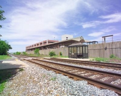
College Park was incorporated by referendum in 1945. However, the city’s origin goes back much further. During the nineteenth and early twentieth centuries, College Park began to emerge from farmland both as a transportation hub and as a center for education. First stagecoaches and then automobiles traveled the turnpike between Baltimore and Washington. College Park was also accessible by rail, which was a popular way to visit Maryland’s new Agricultural College, which later became the University of Maryland.
Turnpike roads were the nation’s first highways serving travelers in horse-drawn vehicles. In 1813, the first turnpike company in Maryland was chartered to construct a link between Baltimore and Washington. The original Baltimore-Washington Turnpike, now US Route 1, is College Park’s main north-south corridor. Travelers along the Turnpike were served by inns and roadhouses, among them the Rossborough Inn. Built in 1804, it was the first stage stop after leaving Washington. Among the Inn’s distinguished visitors were Generals George Washington and Marquis de Lafayette. Today, the Rossborough Inn is part of the University of Maryland.
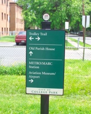
Just after the turn of the century, the streetcar line, which is now Rhode Island Avenue and the Trolley Trail, was extended through College Park to Laurel. The land along the route was gradually bought up and subdivided into new residential suburbs, opening up new business opportunities.
The city’s history coincides with a chapter of American aviation history; the College Park Airport is the world’s oldest continuously operating airport. In 1909, US Army Lieutenant Frank P. Lahm, on the lookout for open and level areas, identified a field on the east side of the Baltimore and Ohio (B&O) Railroad tracks that appeared to be ideal for a flight training school for the Army Signal Corps. This was the beginning of several aviation milestones, including the first woman passenger to fly in an airplane, the first military officer to fly a government airplane, and the first mile-high flight.
[Photo captions:]
William White stands in front of White’s Store, located at US Route 1 and College Avenue. When the building was torn down around 1938 to make way for a new shopping center (photo below), White’s Store moved across College Avenue to what is now the Maryland Book Exchange.
This 1944 view of the Art Deco shopping center includes the building (at the photo’s left) that White’s Store moved to after construction of the shopping center.
Wilbur Wright, seated in the government’s first military plane, the Wright Military Flyer, instructs Lt. Frederic Humphreys in October 1909, Wright came to the College Park
Airfield to train Humphreys and Lt. Frank Lahm to fly it.
The Calvert Store and Post Office, located at the corner of Calvert Road and Bowdoin Avenue, across from what is now the College Park/University of Maryland Metro station was operated by Charles Calvert who sold groceries and other sundry items. The current post office on Calvert Road stands on the same site.
Erected 2008 by Prince George's County.
Topics and series. This historical marker is listed in these topic lists: Agriculture • Education • Railroads & Streetcars • Roads & Vehicles. In addition, it is included in the Art Deco series list. A significant historical month for this entry is October 1909.
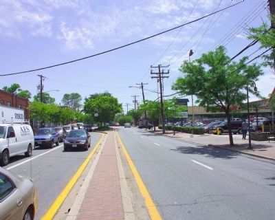
Location. 38° 58.855′ N, 76° 56.261′ W. Marker is in College Park, Maryland, in Prince George's County. Marker is at the intersection of Knox Road and Baltimore Avenue (U.S. 1), on the right when traveling west on Knox Road. Touch for map. Marker is in this post office area: College Park MD 20742, United States of America. Touch for directions.
Other nearby markers. At least 8 other markers are within walking distance of this marker. "The University of Maryland Is Deeply Rooted in History" (about 400 feet away, measured in a direct line); Graham Cracker (about 600 feet away); Washington Quad Renovation (approx. ¼ mile away); Class of 2002 (approx. ¼ mile away); University of Maryland Memorial Chapel (approx. ¼ mile away); Holbrook House (approx. ¼ mile away); The Zeta Beta Chapter of Order of Omega (approx. ¼ mile away); Calvert Hall (approx. 0.3 miles away). Touch for a list and map of all markers in College Park.
Related marker. Click here for another marker that is related to this marker. To better understand the relationship, study each marker in the order shown.
Also see . . . College Park, MD. (Submitted on October 30, 2008, by Richard E. Miller of Oxon Hill, Maryland.)
Photographed By Tom Fuchs
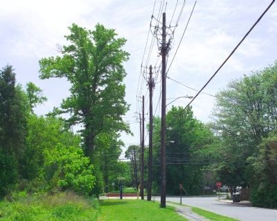
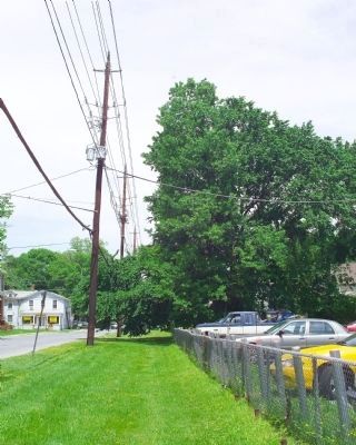
4. Trolley Trail
This is the former right of way of the Washington Railway and Electric Company (WRECo) trolley line between Washington DC and Laurel MD. The location is at Knox Road and Rhode Island Avenue, a couple of blocks from the marker. The picture is looking north toward Laurel.
Credits. This page was last revised on September 14, 2020. It was originally submitted on October 30, 2008, by Richard E. Miller of Oxon Hill, Maryland. This page has been viewed 1,847 times since then and 27 times this year. Last updated on February 18, 2014, by Richard E. Miller of Oxon Hill, Maryland. Photos: 1. submitted on October 30, 2008, by Richard E. Miller of Oxon Hill, Maryland. 2, 3, 4, 5, 6, 7, 8, 9. submitted on May 21, 2009, by Tom Fuchs of Greenbelt, Maryland. • Bill Pfingsten was the editor who published this page.
