Near Eads in Kiowa County, Colorado — The American Mountains (Southwest)
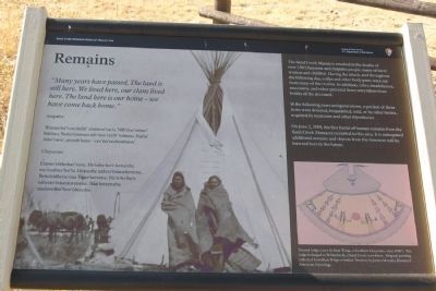
Remains
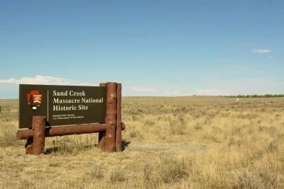
Sand Creek Massacre National Historic Site
”Many years have passed. The land is still here. We lived here, our clans lived here. The land here is our home - we have come back home.”
Arapaho:
Wonoo3ei’i ceciniihi’ coowoo’ou’u. Nih’iine’etiino’ hiitiino. Neito’eininoo nih’iine’etii3i’ hiitiino.Nuhu’ biito’owu’, neyeih’inoo - cee’no’eeckoohuno.
Cheyenne:
Etaose’esehohae’xove. He’tohe ho’e hetseohe eso’eaahtse’ho’ta. Hetseohe nahvo’estaneheveme, Tsetsestahetse naa Tseso’taevetse. He’tohe ho’e nahesto’estestovenone. Naa hetsetseha naeseevaho’hoo’ohtseme.
The Sand Creek Massacre resulted in the deaths of over 150 Cheyenne and Arapaho people, many of them women and children. During the attack, and throughout the following day, scalps and other body parts were cut from many of the victims. In addition, robes, headdresses, moccasins, and other personal items were taken from bodies of the deceased.
In the following years and generations, a portion of these items were donated, bequeathed, sold, or by other means, acquired by museums and other repositories.
On June 2, 2008, the first burial of human remains from the Sand Creek Massacre occurred in this area. It is anticipated additional remains and objects from the massacre will be interred here in the future.
(Lower Right Drawing Caption)
Painted lodge cover by Bear Wings, a Southern Cheyenne, circa 1880's. The lodge belonged to Whiteshield, a Sand Creek eyewitness. Original painting collected from Bear Wings in Indian Territory by James Mooney, Bureau of American Ethnology.
Erected by National Park Service.
Topics. This historical marker is listed in these topic lists: Cemeteries & Burial Sites • Native Americans • Wars, US Indian. A significant historical month for this entry is June 1917.
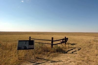
Location. Marker has been reported permanently removed. It was located near 38° 32.944′ N, 102° 30.724′ W. Marker was near Eads, Colorado, in Kiowa County. Marker could be reached from County Road W, 1.3 miles east of County Road 54. Marker is located in Sand Creek Massacre National Historic Site; the above directions are to the intersection of County Road W and the driveway to the park visitor center. Touch for map. Marker was in this post office area: Eads CO 81036, United States of America.
We have been informed that this sign or monument is no longer there and will not be replaced. This page is an archival view of what was.
Other nearby markers. At least 8 other markers are within walking distance of this location. Returned to Sand Creek
(here, next to this marker); Cheyenne and Arapaho Village at Sand Creek (within shouting distance of this marker); A Chief’s Village (within shouting distance of this marker); Dawn November 29, 1864 (within shouting distance of this marker); Sacred Memory (about 300 feet away, measured in a direct line); Fort Lyon Reservation (approx. ¼ mile away); Sand Creek as Camp Site (approx. ¼ mile away); Troops Approach the Village (approx. 0.4 miles away).
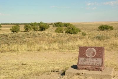
More about this marker. The marker is along the trail to the monument and overlook; it is a 1/2 mile walk from the visitor center parking lot to the marker.
Also see . . .
1. Sand Creek Massacre National Historic Site. Official National Park Service website. (Submitted on February 19, 2014.)
2. Sand Creek Massacre - Wikipedia entry. (Submitted on February 19, 2014.)
Credits. This page was last revised on September 6, 2021. It was originally submitted on February 19, 2014, by Duane Hall of Abilene, Texas. This page has been viewed 1,021 times since then and 19 times this year. Last updated on September 3, 2021, by Connor Olson of Kewaskum, Wisconsin. Photos: 1, 2, 3, 4, 5. submitted on February 19, 2014, by Duane Hall of Abilene, Texas. • J. Makali Bruton was the editor who published this page.
