Near Mosca in Alamosa County, Colorado — The American Mountains (Southwest)
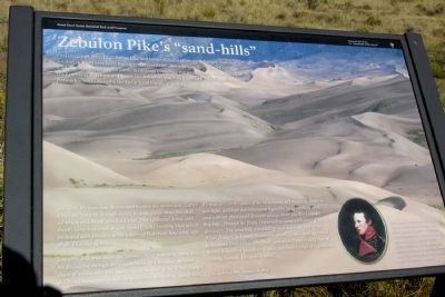
Zebulon Pike's "sand-hills"
Great Sand Dunes National Park and Preserve
— National Park Service, U.S. Department of the Interior —
On January 28, 1807, Lt. Zebulon Pike and his small band of tattered, hungry, foot-sore soldiers camped near here, having just crossed this snowy Sangre de Cristo Mountains. Under orders from General James Wilkinson to explore the southwestern boundaries of the Louisiana Purchase and locate the Arkansas and Red Rivers, Lt. Pike became the first person known to describe the Great Sand Dunes in writing.
Jan. 27th. We marched, determined to cross the mountains ... After a bad day’s march through snows, in some places three feet deep, we struck on a brook which led west. This I followed down, and shortly came to a small stream (Sand Creek), running west, which we hailed with fervency as the waters of Red river. Saw some sign of elk. Distance 14 miles.
Jan 28th. Followed down the ravine ... After marching some miles, we discovered through the lengthy vista, at a distance, another chain of mountains; and nearer by, at the foot of the White (Sangre de Cristo) mountains which we were then descending, sandy hills.
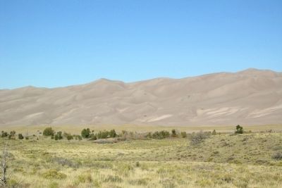
We marched on the outlet of the mountains, left the sandy desert to our right, and kept down between it and the largest hills of sand, and with my glass could discover a large river (the Rio Grande) flowing ... through the plain. I returned to camp with news of my discovery. The sand-hills extended up and down the foot of the White (Sangre de Cristo) mountains about 15 miles, and appeared to be about 5 miles in width. Their appearance was exactly that of the sea in a storm, except as to color, not the least sign of vegetation existing thereon. Distance 15 miles.
- Lt. Zebulon Pike, January 28, 1807
(Lower Right Drawing Caption)
Pike’s journey took an unexpected turn a few days after his visit to the dunes. While camped along the Rio Grande which he mistook for the Red River, he was contacted by Spanish soldiers who informed him he was trespassing on Spanish territory. He and his men were escorted to Chihuahua, Mexico, and later returned to Louisiana.
Erected by National Park Service, U.S. Department of the Interior.
Topics. This historical marker is listed in this topic list: Exploration. A significant historical month for this entry is January 1807.
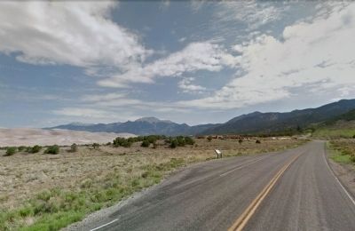
Location. 37° 43.844′ N, 105° 30.833′ W. Marker is near Mosca, Colorado, in Alamosa County. Marker is on State Highway 150, 0.2 miles south of Visitor Center Entrance Driveway, on the left when traveling north. Touch for map. Marker is in this post office area: Mosca CO 81146, United States of America. Touch for directions.
Other nearby markers. At least 8 other markers are within 7 miles of this marker, measured as the crow flies. Sangre de Cristo Ecosystem (approx. 0.2 miles away); The Mountain Barrier (approx. 0.2 miles away); Dimensions
(approx. 0.6 miles away); Stepping into Wilderness (approx. 0.6 miles away); A Landmark for People (approx. 2.1 miles away); "Totally Unique and Unexpected" (approx. 3 miles away); Understanding the Great Sand Dunes System: the Sand Sheet (approx. 6.7 miles away); Sounds of Silence (approx. 6.7 miles away). Touch for a list and map of all markers in Mosca.
Also see . . . Great Sand Dunes National Park and Preserve. Official National Park Service website. (Submitted on February 20, 2014.)
Credits. This page was last revised on October 21, 2020. It was originally submitted on February 20, 2014, by Duane Hall of Abilene, Texas. This page has been viewed 732 times since then and 25 times this year. Photos: 1, 2, 3. submitted on February 20, 2014, by Duane Hall of Abilene, Texas.


