Downtown in Omaha in Douglas County, Nebraska — The American Midwest (Upper Plains)
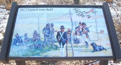
the Council was held
Sergeant Charles Floyd, August 3, 1804
Near here, the Corps of Discovery held its first council, making speeches and presenting gifts to the Otoe and Missouria. Communicating through an interpreter, members of the Expedition believed their messages were clear. But were they?
This meeting was the first of many formal and informal exchanges between members of the Expedition and tribes along the trail. The Expedition crossed the territories of more than 100 American Indian tribes. Oral tradition, passed from generation to generation within tribes, preserves their stories of the Expedition.
Erected by National Park Service, U.S. Department of the Interior.
Topics and series. This historical marker is listed in these topic lists: Exploration • Government & Politics • Native Americans. In addition, it is included in the Lewis & Clark Expedition series list.
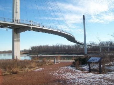
Location. 41° 15.918′ N, 95° 55.439′ W. Marker is in Omaha, Nebraska, in Douglas County. It is in Downtown. Marker is on the grounds of the National Park Service Lewis and Clark National Historic Trail Headquarters. Touch for map. Marker is at or near this postal address: 601 Riverfront Drive, Omaha NE 68102, United States of America. Touch for directions.
Other nearby markers. At least 8 other markers are within walking distance of this marker. Capt. Lewis…will…give us accounts of new things only (a few steps from this marker); endeavor to make yourself acquainted…with…the nations (a few steps from this marker); Nature exerted herself to butify the Senery (within shouting distance of this marker); Westwardly by the Waters (within shouting distance of this marker); A River of Hope (within shouting distance of this marker); People, Places, and Stories (about 300 feet away, measured in a direct line); Preserving Our Heritage (about 300 feet away); A River of Change (about 400 feet away). Touch for a list and map of all markers in Omaha.
Also see . . .
1. Lewis and Clark National Historic Trail. (Submitted on March 2, 2014, by William Fischer, Jr. of Scranton, Pennsylvania.)
2. The Journals of the Lewis and Clark Expedition. (Submitted on March 2, 2014, by William Fischer, Jr. of Scranton, Pennsylvania.)
Additional keywords. the Council was held
Credits. This page was last revised on February 16, 2023. It was originally submitted on March 2, 2014, by William Fischer, Jr. of Scranton, Pennsylvania. This page has been viewed 525 times since then and 26 times this year. Photos: 1, 2. submitted on March 2, 2014, by William Fischer, Jr. of Scranton, Pennsylvania.

