Near Baldwyn in Prentiss County, Mississippi — The American South (East South Central)
Brice's Cross Roads
Union Retreat -- Defense at the Bridge
Inscription.
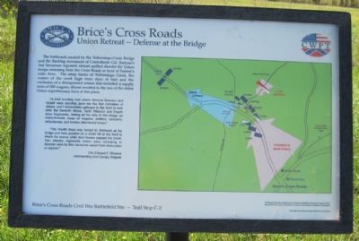
The bottleneck created by the Tishomingo Creek Bridge and the flanking movement of Confederate Colonel Barteau's 2nd Tennessee regiment almost spelled diaster for Union troops retreating from the Cross Roads in front of Forrest's main force. The steep banks of Tishomingo Creek, the waters of the creek high from days of rain and the confusion of a disorganized retreat that included a supply train of 200 wagons, almost resulted in the loss of the entire Union expeditionary force at this place.
"A shell bursting near where General Grierson and myself were standing gave me the first intimation of defeat, and I immediately galloped to the front to look after the Seventh Illinois, Tenth Missouri and Fourth Iowa Regiments, finding all the way to the bridge an indiscriminate mass of wagons, artillery, caissons, ambulances, and broken, disorganized troops."
"The Fourth Iowa was forced to dismount at the bridge and take position on a small hill at the front to check the enemy while their horses passed the creek. Two infantry regiments which were retreating in disorder were by this maneuver saved from destruction or capture." —Colonel Edward F. Winslow, commanding 2nd Cavalry Brigade
Erected by Civil War Preservation Trust. (Marker Number C-2.)
Topics. This historical marker is listed in this topic list: War, US Civil.
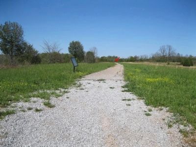
Location. 34° 30.722′ N, 88° 43.855′ W. Marker is near Baldwyn, Mississippi, in Prentiss County. Marker can be reached from State Highway 370, 0.4 miles west of Bethany Road (State Highway 370), on the right when traveling west. The Tishomingo Overlook Road is a short park road that ends at a parking area and overlook (Auto Tour Stop 7). The marker is about 280 feet from the start of a Battlefield Walking Trail (Log Cabin Road) that starts at the parking area. Touch for map. Marker is in this post office area: Baldwyn MS 38824, United States of America. Touch for directions.
Other nearby markers. At least 8 other markers are within walking distance of this marker. A different marker also named Brice's Cross Roads (within shouting distance of this marker); Artillery at Log Cabin Ridge (about 300 feet away, measured in a direct line); Terrain and Landscape (about 400 feet away); Union Wagon Train (about 500 feet away); General Barteau's Flank Movement (about 700 feet away); Tishomingo Creek Bridge (about 700 feet away); Chief Tishomingo (about 800 feet away); a different marker also named Tishomingo Creek Bridge (about 800 feet away). Touch for a list and map of all markers in Baldwyn.
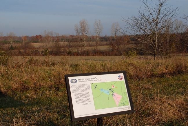
Regarding Brice's Cross Roads. The marker includes a map illustrating Union troops
trying to escape the bottleneck at the bridge as Forrest's line converges on their rearguard.
Also see . . .
1. Brices Cross Roads National Battlefield Site. National Park Service (Submitted on March 7, 2014.)
2. The Battle of Brice's Crossroads. Civil War Trust (Submitted on March 7, 2014.)
Credits. This page was last revised on June 16, 2016. It was originally submitted on March 7, 2014, by David Graff of Halifax, Nova Scotia. This page has been viewed 595 times since then and 16 times this year. Photos: 1, 2. submitted on March 7, 2014, by David Graff of Halifax, Nova Scotia. 3. submitted on September 27, 2015, by Brandon Fletcher of Chattanooga, Tennessee. 4. submitted on March 7, 2014, by David Graff of Halifax, Nova Scotia. • Bernard Fisher was the editor who published this page.


