West Blocton in Bibb County, Alabama — The American South (East South Central)
West Blocton, Alabama
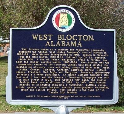
West Blocton began as a business and residential community adjoining the Cahaba Coal Mining Company's town of Blocton in 1883-84. West Blocton incorporated in 1901. Eugene D. Reynolds was the first mayor, 1901-1904, followed by Dr. L.E. Peacock, 1904-1906. A son of Italian Immigrants, Frank T. Ferrire, has been the longest serving mayor, 1965-1984. West Blocton was the commercial center of the southern Cahaba coal field serving the neighboring company towns and mining camps of Belle Ellen, Piper, Lucille, Gurnee, Coleanor, Garnsey, Galloway, Marvel, Moffatt, Masena, Braehead, Red Eagle and Hargrove. Economic opportunity attracted a diverse population. An Italian Catholic Cemetery lies just east of town and the League of Brothers Synagogue was built on Main Street in 1905. Bibb County's first bank, the Blocton Savings Bank was established in 1892. By 1910, West Blocton boasted of 55 businesses including a newspaper, bottling works, hotels, general stores, lawyers, doctors, photographers, shoemaker, tailor and dentist offices. West Blocton is now the home of the Cahaba Lily Festival.
Erected 2010 by Alabama Tourism Department and the Town of West Blocton.
Topics. This historical marker is listed in these topic lists: Industry & Commerce • Settlements & Settlers. A significant historical year for this entry is 1901.
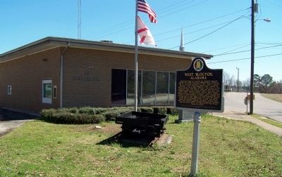
Location. 33° 7.052′ N, 87° 6.889′ W. Marker is in West Blocton, Alabama, in Bibb County. Marker is at the intersection of Main Street and Walter Owens Drive, on the left when traveling east on Main Street. It is located in front of the West Blocton Town Hall. Touch for map. Marker is at or near this postal address: 1139 Main Street, West Blocton AL 35184, United States of America. Touch for directions.
Other nearby markers. At least 8 other markers are within 8 miles of this marker, measured as the crow flies. The Railway System (approx. 0.4 miles away); What Are Coke Ovens? (approx. 0.4 miles away); Welcome to West Blocton Coke Ovens Park (approx. half a mile away); Blocton / Blocton Coke Ovens (approx. half a mile away); Belle Ellen (approx. 1.8 miles away); Piper / Coleanor (approx. 4.7 miles away); Town of Woodstock (approx. 7 miles away); Skirmish at Trion (approx. 8 miles away). Touch for a list and map of all markers in West Blocton.
Credits. This page was last revised on June 16, 2016. It was originally submitted on March 13, 2014, by David J Gaines of Pinson, Alabama. This page has been viewed 1,110 times since then and 67 times this year. Photos: 1, 2. submitted on March 13, 2014, by David J Gaines of Pinson, Alabama. • Bernard Fisher was the editor who published this page.

