Parkers Crossroads in Henderson County, Tennessee — The American South (East South Central)
A Fire Terrible In Its Intensity
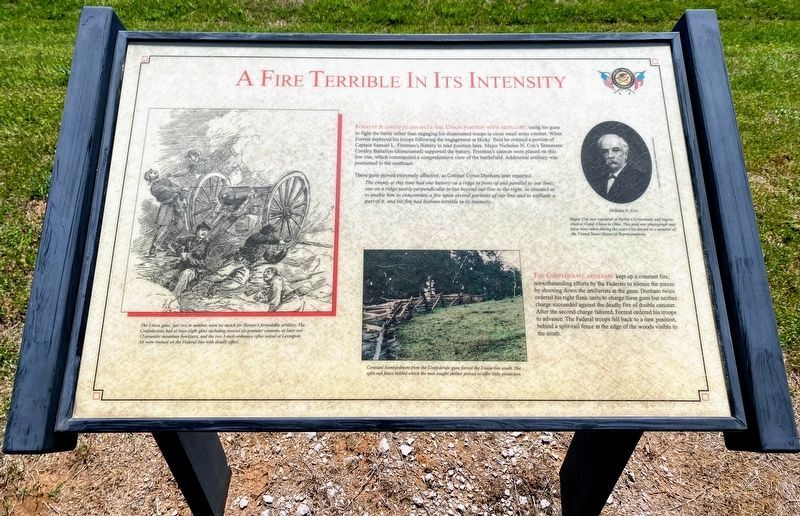
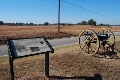
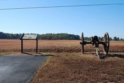
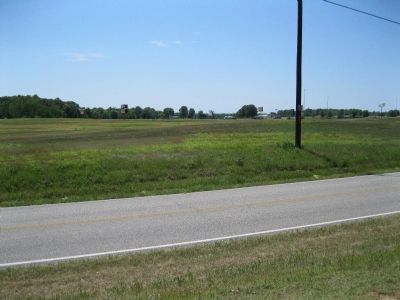
Forrest planned to encircle the Union position with artillery, using his guns to fight the battle rather than engaging his dismounted troops in close small arms combat. When Forrest deployed his troops following the engagement at Hicks' field he ordered a portion of Captain Samuel L. Freeman's Battery to take position here. Major Nicholas N. Cox's Tennessee Cavalry Battalion (dismounted) supported the battery. Freeman's cannon were placed on this low rise, which commanded a comprehensive view of the battlefield. Additional artillery was positioned to the southeast.
These guns proved extremely affective, as Colonel Cyrus Dunham later reported: The enemy at this time had one battery on a ridge in front of and parallel to our line; one on a ridge nearly perpendicular to but beyond our line to the right, so situated as to enable him to concentrate a fire upon several portions of our line and to enfilade a part of it, and his fire had become terrible in its intensity.
The Confederate artillery kept up a constant fire, notwithstanding efforts by the Federals to silence the pieces by shooting down the artillerists at the guns. Dunham twice ordered his right flank units to charge these guns but neither charge succeeded against the deadly fire of double canister. After the second charge faltered, Forrest ordered his troops to advance. The Federal troops fell back to a new position behind a split-rail fence at the edge of the woods visible to the south.
Erected by Parker's Crossroads Battlefield Association.
Topics. This historical marker is listed in this topic list: War, US Civil.
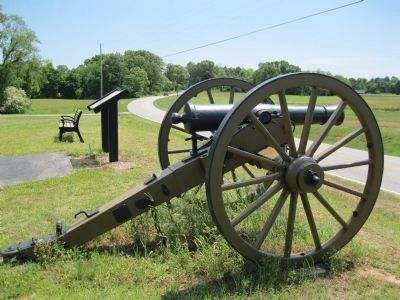
Location. 35° 47.618′ N, 88° 23.132′ W. Marker is in Parkers Crossroads, Tennessee, in Henderson County. Marker can be reached from Tennessee Route 22, 0.6 miles north of Interstate 40, on the right when traveling north. Marker is on the North Loop Walking Trail ½ mile from the start of the trail. This marker is at a cannon wayside at the end of the eastern extension off the loop trail. The North Loop Walking Trail is at Tour Stop #1 (Parkers Crossroads City Park) of the Driving Tour. Touch for map. Marker is in this post office area: Wildersville TN 38388, United States of America. Touch for directions.
Other nearby markers. At least 8 other markers are within walking distance of this marker. Forrest's Big Show (about 300 feet away, measured in a direct line); Forrest Seizes the Advantage (about 300 feet away); Confederate Horseholders (about 700 feet away); Manning the Guns (about 700 feet away); The Battle Begins (about 700 feet away); Civil War Artillery (about 800 feet away); A Panicked Stampede (approx. 0.2 miles away); Dunham Strikes Back (approx. 0.2 miles away). Touch for a list and map of all markers in Parkers Crossroads.
More about this marker. On the left is a drawing of a Union cannon in action with the caption: The Union guns, just two in number, were no match for Forrest's formidable artillery. The Confederates had at least eight guns including several six-pounder cannons, at least two 12-pounder mountain howitzers, and the two 3-inch ordnance rifles seized at Lexington. All were trained on the Federal line with deadly effect.
In the center is a modern photo of the Split-Rail Fence with the caption: Constant bombardment from the Confederate guns forced the Union line south. The split-rail fence behind which the men sought shelter proved to offer little protection.
On the right is a portrait of Nicholas N. Cox with the caption: Major Cox was captured at Parker's Crossroads and imprisoned at Camp Chase in Ohio. This post-war photograph may have been taken during the years Cox served as a member of the United States House of Representatives. Courtesy Parker's Crossroads Battlefield Association
This marker is visible in Google Streetview beside Bluegrass Lane along with a 360° view of its surroundings.
Additional keywords. Parkers Crossroads
Credits. This page was last revised on June 3, 2021. It was originally submitted on March 15, 2014, by David Graff of Halifax, Nova Scotia. This page has been viewed 525 times since then and 3 times this year. Photos: 1. submitted on May 30, 2021, by Shane Oliver of Richmond, Virginia. 2, 3. submitted on August 22, 2015, by Brandon Fletcher of Chattanooga, Tennessee. 4, 5. submitted on March 15, 2014, by David Graff of Halifax, Nova Scotia. • Bernard Fisher was the editor who published this page.
