Sharpsburg in Washington County, Maryland — The American Northeast (Mid-Atlantic)
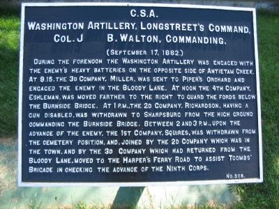
Washington Artillery, Longstreet's Command
Washington Artillery, Longstreet's Command,
Col. J. B. Walton Commanding.
(September 17, 1862.)
During the forenoon the Washington Artillery was engaged with the enemy's heavy batteries on the opposite side of Antietam Creek. At 9:15, the 3d Company, Miller, was sent to Piper's Orchard and engaged the enemy in the Bloody Lane. At noon the 4th Company, Eshelman, was moved farther to the right to guard the fords below the Burnside Bridge. At 1 p.m., the 2d Company, Richardson, having a gun disabled, was withdrawn to Sharpsburg from the high ground commanding the Burnside Bridge. Between 2 and 3 p.m., upon the advance of the enemy, the 1st Company, Squires, was withdrawn in the town, and by the 3d Company which had returned from the Bloody Lane, moved to the Harper's Ferry Road to assist Toombs' Brigade in checking the advance of the Ninth Corps.
Erected by Antietam Battlefield Board. (Marker Number 308.)
Topics and series. This historical marker is listed in this topic list: War, US Civil. In addition, it is included in the Antietam Campaign War Department Markers series list. A significant historical year for this entry is 1862.
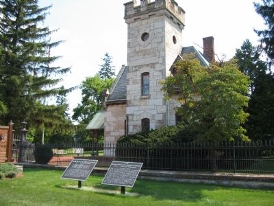
Location. 39° 27.609′ N, 77° 44.515′ W. Marker is in Sharpsburg, Maryland, in Washington County. Marker is on Boonsboro Pike (State Highway 34), on the right when traveling east. Located at the entrance of the National Cemetery, stop eleven on the driving tour of Antietam Battlefield. Touch for map. Marker is in this post office area: Sharpsburg MD 21782, United States of America. Touch for directions.
Other nearby markers. At least 8 other markers are within walking distance of this marker. A different marker also named Washington Artillery, Longstreet's Command (here, next to this marker); Not For Themselves, But For Their Country (a few steps from this marker); Evans' Brigade, Longstreet's Command (a few steps from this marker); Antietam National Cemetery (a few steps from this marker); a different marker also named Evans' Brigade, Longstreet's Command (within shouting distance of this marker); Squires’ Battery, 1st Company Washington Artillery of New Orleans (within shouting distance of this marker); Longstreet's Command (within shouting distance of this marker); a different marker also named Longstreet's Command (within shouting distance of this marker). Touch for a list and map of all markers in Sharpsburg.
Also see . . .
1. Antietam Battlefield. National Park Service site. (Submitted on April 20, 2008, by Craig Swain of Leesburg, Virginia.)
2. 1st Battalion, Longstreet's Artillery. Walton records the battalion's casualties as four killed, 28 wounded, and two
missing. This is remarkable, as the batteries seem to have been engaged throughout the day at various critical points on the battlefield. (Submitted on April 20, 2008, by Craig Swain of Leesburg, Virginia.)

Photographed By Craig Swain, April 6, 2008
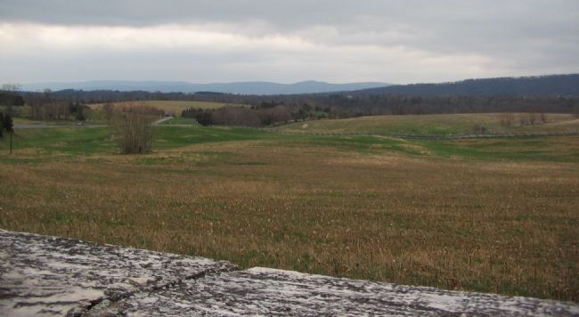
3. 1st Company (Squires') Position
During most of the 16th and 17th, Squire's Battery maintained a position near what is today the northeast corner of the National Cemetery. Looking over the wall of the cemetery, to the east down Boonsboro Pike (running from the far left into the distance), the positions held by Federal horse artillery are visible. Those positions ran from the open ground just left of center in the distance, to the south of the pike. Looking over Rodman Avenue (running left to right with the snake rail fence in the center frame), is the high ground used by the 2nd and 10th U.S. Regulars. Their advance caused the relocation of Squires' guns.
Credits. This page was last revised on December 7, 2017. It was originally submitted on April 20, 2008, by Craig Swain of Leesburg, Virginia. This page has been viewed 824 times since then and 11 times this year. Photos: 1, 2, 3. submitted on April 20, 2008, by Craig Swain of Leesburg, Virginia.

