Overton in Clark County, Nevada — The American Mountains (Southwest)
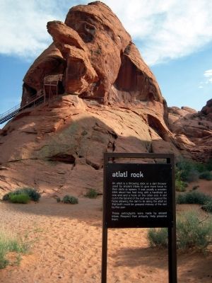
Atlatl Rock
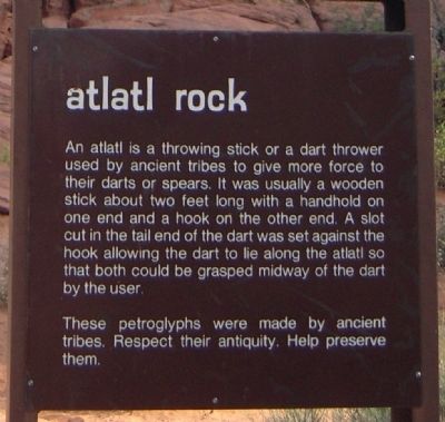
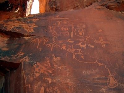
These petroglyphs were made by ancient tribes. Respect their antiquity. Help preserve them.
Erected by Valley of Fire State Park.
Topics. This historical marker is listed in this topic list: Natural Features.
Location. 36° 25.397′ N, 114° 33.039′ W. Marker is near Overton, Nevada, in Clark County. Marker can be reached from Atlatl Rock south of Campground Road. Marker is located in Valley of Fire State Park; Campground Road is accessible from Valley of Fire Highway at the Atlatl Rock Campground. Touch for map. Marker is in this post office area: Overton NV 89040, United States of America. Touch for directions.
Other nearby markers. At least 8 other markers are within 5 miles of this marker, measured as the crow flies. Beehives (approx. 0.7 miles away); Nevada’s First State Park (approx. 2.1 miles away); Valley of Fire (approx. 2.1 miles away); Silica Dome (approx. 3˝ miles away); The Cabins (approx. 3.9 miles away); Valley of Fire Behind the Camera (approx. 4.2 miles away); In Memory of Sergeant John J. Clark (approx. 4.7 miles away); Arrowhead Trail (approx. 4.9 miles away). Touch for a list and map of all markers in Overton.
Also see . . . Valley of Fire State Park. Official website of Nevada State Parks. (Submitted on March 16, 2014.)
Credits. This page was last revised on February 7, 2023. It was originally submitted on March 16, 2014, by Duane Hall of Abilene, Texas. This page has been viewed 565 times since then and 14 times this year. Photos: 1, 2, 3. submitted on March 16, 2014, by Duane Hall of Abilene, Texas.


