Parkers Crossroads in Henderson County, Tennessee — The American South (East South Central)
Fuller's Assault
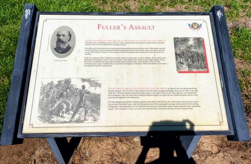
Colonel John W. Fuller's Ohio Brigade left Huntingdon well before dawn on December 31. When just north of Clarksburg, around 10:30 a.m., Fuller received orders from Generals Jeremiah Sullivan and Isham Haynie to wait for the rear guard before resuming the march.
Soon afterward, Fuller learned that an enemy patrol had attacked the generals and their escort. Fuller quickly marched toward Clarksburg, where he learned that an enemy patrol had attacked the generals and their escort. Fuller quickly marched toward Clarksburg, where he learned that Dunham's brigade had left some hours earlier. After a ten-minute wait with no word from Sullivan or Haynie, Fuller pressed southward. The brigade had not advanced far when they heard cannonading.
Fuller was within two miles of Parker's Crossroads when he received orders to wait for Sullivan, who was three miles behind him and coming up quickly with the rear guard. Fuller explained the situation to the brigade adjutant, telling him to hurry to Sullivan and request the general countermand his orders. Soon thereafter, Fuller received confirmation that a large Confederate force was between his brigade and Dunham's. Fuller immediately moved south, convinced that Sullivan would approve.
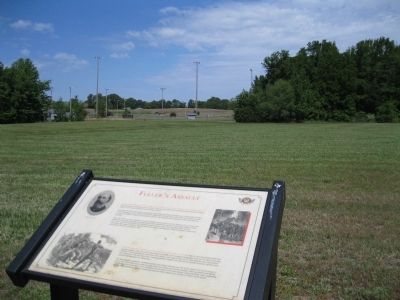
Fuller's Brigade advanced to the battlefield and took position as flags of truce were being passed near the split-rail fence. The 27th and 63rd Ohio formed on the left of the Lexington-Huntingdon Road, the 39th Ohio on the right, while the 7th Wisconsin Battery readied their three cannon on the ridge in front of you. Their approach went unnoticed by the Confederates, who were intent upon watching Dunham's brigade, now split into two isolated remnants, and the Union surrender that appeared to be taking place.
The Ohio Brigade attacked the Confederate gunners and infantry from the rear. Two Union cannon were moved to a position in front of the Parker house while the third, placed west of the road, poured a barrage of shot and shell on the fleeing Confederates. The horseholders of Cox's battalion took the brunt of the initial infantry assault and broke ranks, stampeding in panic. The Confederate victory, so certain just moments before, dissolved in the face of Fuller's timely assault.
Erected by Parker's Crossroads Battlefield Association.
Topics. This historical marker is listed in this topic list: War, US Civil. A significant historical month for this entry is December 1755.
Location. 35° 47.704′ N, 88° 23.324′ W. Marker is in Parkers Crossroads, Tennessee, in Henderson County. Marker can be reached from Tennessee Route 22, 0.6 miles north of Interstate 40, on the right
when traveling north. Marker is on the North Loop Walking Trail ½ mile from the start of the trail. The North Loop Walking Trail is at Tour Stop #1 (Parkers Crossroads City Park) of the Driving Tour. Touch for map. Marker is in this post office area: Wildersville TN 38388, United States of America. Touch for directions.
Other nearby markers. At least 8 other markers are within walking distance of this marker. "Charge Them Both Ways" (within shouting distance of this marker); "Give 'Em Hell" (within shouting distance of this marker); Flight to Safety (about 300 feet away, measured in a direct line); Confederate Horseholders (about 400 feet away); The Battle Begins (about 500 feet away); Parker's Cross Roads (about 500 feet away); Forrest's Tactics (about 500 feet away); Prelude to Battle/December 31, 1862—the Battle/Union and Confederate Forces (about 600 feet away). Touch for a list and map of all markers in Parkers Crossroads.
More about this marker. On the upper left is a portrait of Colonel John W. Fuller — Courtesy Parker's Crossroads Battlefield Association
On the upper right is a drawing of a Union column on the march and on the lower left is a drawing of Union infantry advancing into battle.
Additional keywords. Parkers Crossroads
Credits. This page was last revised on June 3, 2021. It was originally submitted on March 17, 2014, by David Graff of Halifax, Nova Scotia. This page has been viewed 519 times since then and 8 times this year. Photos: 1. submitted on May 30, 2021, by Shane Oliver of Richmond, Virginia. 2, 3. submitted on March 17, 2014, by David Graff of Halifax, Nova Scotia. • Bernard Fisher was the editor who published this page.


