Near Parkers Crossroads in Henderson County, Tennessee — The American South (East South Central)
Flight to Safety
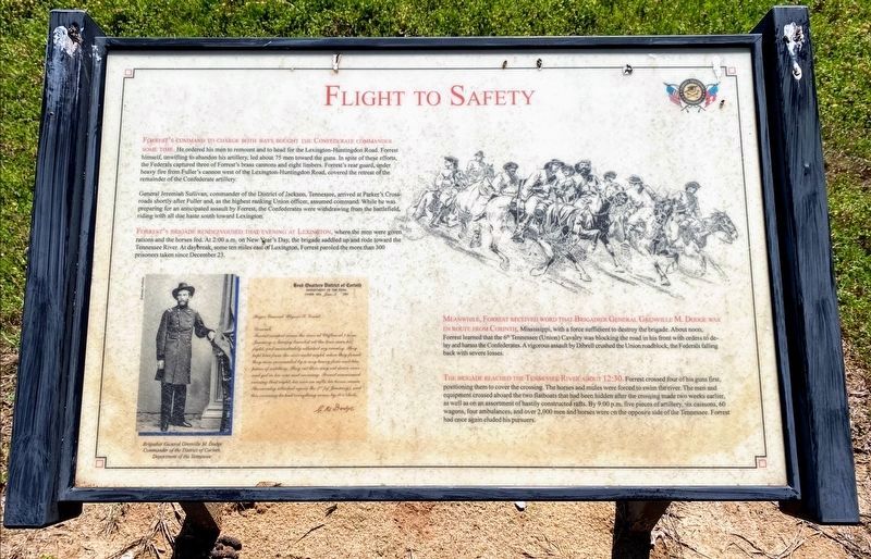
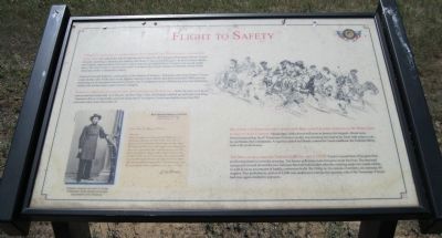
Forrest's command to charge both ways bought the Confederate commander some time. He ordered his men to remount and to head for the Lexington-Huntingdon Road, Forrest himself, unwilling to abandon his artillery, led about 75 men toward the guns. In spite of these efforts, the Federals captured three of Forrest's brass cannons and eight limbers. Forrest's rear guard, under heavy fire from Fuller's cannon west of the Lexington-Huntingdon Road, covered the retreat of the remainder of the Confederate artillery.
General Jeremiah Sullivan, commander of the District of Jackson, Tennessee, arrived at Parker's Crossroads shortly after Fuller and, as the highest ranking Union officer, assumed command. While he was preparing for an anticipated assault by Forrest, the Confederates were withdrawing from the battlefield, riding with all due haste south toward Lexington.
Forrest's brigade rendezvoused that evening at Lexington, where the men were given rations and the horses fed. At 2:00 a.m. on New Year's Day, the brigade saddled up and rode toward the Tennessee River. At daybreak, some ten miles east of Lexington, Forrest paroled the more than 300 prisoners taken since December 23.
Meanwhile, Forrest received word that Brigadier General Grenville M. Dodge was en route from Corinth, Mississippi, with a force sufficient to destroy the brigade. About noon, Forrest learned that the 6th Tennessee (Union) Cavalry was blocking the road in front with orders to delay and harass the Confederates. A vigorous assault by Dibrell crushed the Union roadblock, the Federals falling back with severe losses.
The brigade reached the Tennessee River about 12:30. Forrest crossed four of his guns first positioning them to cover the crossing. The horses and mules were forced to swim the river. The men and equipment crossed aboard the two flatboats that had been hidden after the crossing made two weeks earlier, as well as on an assortment of hastily constructed rafts. By 9:00 p.m. five pieces of artillery, six caissons, 60 wagons, four ambulances, and over 2,000 men and horses were on the opposite side of the Tennessee. Forrest had once again eluded his pursuers.
(sidebar)
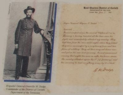
General Dodge's Report on Forrest's Escape
Head Quarters District of Corinth
Department of the Tennessee
Corinth, Miss., January 3, 1863
(To) Major General Ulysses S. Grant
General: Forrest escaped across the river at Clifton at 7 a.m. January 1, having traveled all the time since his fight, and immediately attacked my cavalry. They kept him from the river until night, when they found they were surrounded by a very heavy force and two pieces of artillery. They cut their way out down river and got into his rear next morning. Forrest commenced crossing that night, his men on rafts, his horses swam. The cavalry attacked again the 2d (of January), and this morning he had everything across by 10 o'clock. - G.M. Dodge
Photo Inset is captioned Brigadier General Grenville M. Dodge, Commander of the District of Corinth, Department of the Tennessee
Erected by Parker's Crossroads Battlefield Association.
Topics. This historical marker is listed in this topic list: War, US Civil. A significant historical date for this entry is January 3, 1863.
Location. 35° 47.737′ N, 88° 23.381′ W. Marker is near Parkers Crossroads, Tennessee, in Henderson County. Marker can be reached from Tennessee Route 22, 0.6 miles north of Interstate 40, on the right when traveling north. Marker is on the North Loop Trail at Tour Stop 1, Parkers Crossroads City Park. Touch for map. Marker is in this post office area: Wildersville TN 38388, United States of America. Touch for directions.
Other nearby markers. At least 8 other markers are within walking distance of this marker. "Charge Them Both Ways" (within shouting distance of this marker); Forrest's Tactics (within shouting distance of this marker); Forrest's West Tennessee Raid (about 300 feet away, measured in a direct line); Morton's Battery (about 300 feet away); The Battle of Parker's Crossroads
(about 300 feet away); "Give 'Em Hell" (about 300 feet away); Parker's Cross Roads (about 300 feet away); Fuller's Assault (about 300 feet away). Touch for a list and map of all markers in Parkers Crossroads.
More about this marker. The marker includes a drawing of a Confederate cavalry charge.
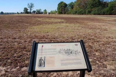
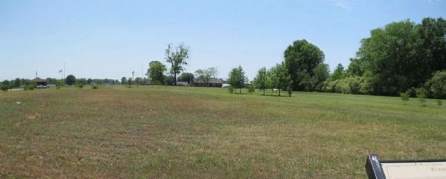
Regarding Flight to Safety. Forrest's charge was staged beyond the view of this marker. A panorama of that field is shown on the related marker page.
Related marker. Click here for another marker that is related to this marker.
Also see . . . Parker's Crossroads Battlefield. Website homepage (Submitted on March 7, 2013, by David Graff of Halifax, Nova Scotia.)
Additional keywords. Parkers Crossroads
Credits. This page was last revised on February 27, 2022. It was originally submitted on March 6, 2013, by David Graff of Halifax, Nova Scotia. This page has been viewed 607 times since then and 19 times this year. Last updated on March 17, 2014, by David Graff of Halifax, Nova Scotia. Photos: 1. submitted on May 30, 2021, by Shane Oliver of Richmond, Virginia. 2. submitted on August 22, 2015, by Brandon Fletcher of Chattanooga, Tennessee. 3. submitted on March 6, 2013, by David Graff of Halifax, Nova Scotia. 4. submitted on August 22, 2015, by Brandon Fletcher of Chattanooga, Tennessee. 5. submitted on March 6, 2013, by David Graff of Halifax, Nova Scotia. • Bernard Fisher was the editor who published this page.
