Niagara Falls in Niagara County, New York — The American Northeast (Mid-Atlantic)
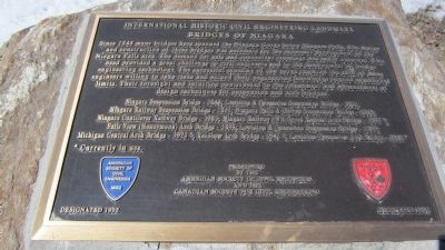
Bridges of Niagara
International Historic Civil Engineering Landmark
Niagara Suspension Bridge - 1848; Lewiston & Queenston Suspension Bridge - 1851; Niagara Railway Suspension Bridge - 1855; Niagara Falls and Clifton Suspension Bridge - 1869; Niagara Cantilever Railway Bridge - 1883; Niagara Railway (Whirlpool Rapids) Arch Bridge - 1897*; Falls View (Honeymoon) Arch Bridge - 1898; Lewiston & Queenston Suspension Bridge - 1899; Michigan Central Arch Bridge - 1925*; Rainbow Arch Bridge - 1941*; Lewiston-Queenston Arch Bridge - 1962*
* Currently in use.
American Society of Civil Engineers 1852 CSCE SCGC Designated 1992 Dedicated 2005
Presented by The American Society of Civil Engineers and The Canadian Society for Civil Engineering.
Erected 2005 by The American Society of Civil Engineers and The Canadian Society for Civil Engineering.
Topics and series. This historical marker is listed in this topic list: Bridges & Viaducts. In addition, it is included in the ASCE Civil Engineering Landmarks series list. A significant historical year for this entry is 1848.
Location. 43° 5.347′ N, 79° 3.878′ W. Marker is in Niagara Falls, New York, in Niagara County. Marker is on the paved footpath along the rim of the Niagara Gorge in Niagara Falls State Park (Niagara Reservation State Park), adjacent to the north side of the Rainbow Bridge and the decommissioned section of the Robert Moses Parkway that ducks underneath the apron of the Rainbow Bridge. Touch for map. Marker is in this post office area: Niagara Falls NY 14303, United States of America. Touch for directions.
Other nearby markers. At least 8 other markers are within walking distance of this marker. Replica of the Statue of Liberty (about 400 feet away, measured in a direct line); The Falls View Bridges (about 600 feet away); The First People to See the Falls (approx. 0.2 miles away); Lake Ontario (approx. 0.2 miles away); Hennepin View (approx. 0.2 miles away); David Hill (approx. ¼ mile away); Chief Clinton Rickard (approx. ¼ mile away); Sophie Martin (approx. ¼ mile away). Touch for a list and map of all markers in Niagara Falls.
More about
Photographed By Anton Schwarzmueller, March 17, 2014
2. Northward View Bridges of Niagara Marker
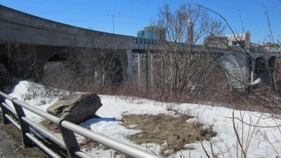
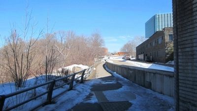
The marker is on the boulder left of the railing just beyond the shade. The gorge is immediately left of the boulder. To the right is the decommissioned section of the Robert Moses Parkway and the maintenence and operations area of the Rainbow Bridge owner, the Niagara Falls Bridge Commission. It is also the back side of the Duty Free store. The orange girder structure in the distance is a heliopad for a seasonal tourist operation.
Regarding Bridges of Niagara. Please see the photo captions, links, and the links on the Falls View Bridges marker page for additional information.
Related markers. Click here for a list of markers that are related to this marker. Markers pertaining to bridges over the Niagara River Gorge.
Also see . . .
1. Historic Bridges - Rainbow Bridge. (Submitted on March 17, 2014, by Anton Schwarzmueller of Wilson, New York.)
2. Historic Bridges - Michigan Central Railway Bridge. (Submitted on March 17, 2014, by Anton Schwarzmueller of Wilson, New York.)
3. Historic Bridges - Whirlpool Rapids Bridge. Also refered to as The Lower Bridge, meaning farther downstream. (Submitted on March 17, 2014, by Anton Schwarzmueller of Wilson, New York.)
4. Wikipedia entry for Niagara Falls Suspension Bridge. Excerpt:
Trains used the upper of its two decks, while pedestrians and carriages used the lower. The bridge was part of Canadian politician William Hamilton Merritt's vision to promote trade within his country and with its neighbor the United States. Many argued that a suspension bridge could not support the safe passage of trains, including bridge builders.(Submitted on March 6, 2021, by J. J. Prats of Powell, Ohio.)
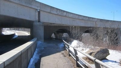
The Suspension Bridge was a border crossing between Canada and the United States, and it played significant roles in the historiesof the Niagara region and the two countries. Three railway lines crossed over the bridge, connecting cities on both sides of the border. The Great Western Railway, New York Central Railroad, and New York and Erie Rail Road differed in track gauge; the bridge used a triple gauge system to conserve space, overlapping two tracks on top of each other and using a rail of each to form the third track. The railroads brought a large influx of trade and tourists into the region around the Niagara Falls. In the time leading to the American Civil War, the Underground Railroad helped slaves in the United States escape across the Suspension Bridge to freedom in Canada. After the war, the bridge became a symbol of inspiration to Americans, encouraging them to rebuild their country and pushing them to quickly industrialize their nation.Photographed By Anton Schwarzmueller, March 17, 20143. Southward View Bridges of Niagara MarkerMarker is on the boulder to the right. The decommissioned section of the Robert Moses Parkway is to the left. Ahead is the Rainbow Bridge apron. Beyond the apron and unseen is the Falls View Bridges marker. See the security camera in this picture?
The bridge's success proved that a railway suspension bridge could be safe and operational. Its wooden structures began to decay and were replaced with stronger steel and iron versions by 1886. Heavier trains required it to be replaced by the Steel Arch Bridge, later renamed the Whirlpool Rapids Bridge, on August 27, 1897.
Photographed By Anton Schwarzmueller, March 17, 2014
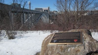
6. Northward View of Gorge and Bridges of Niagara Marker Boulder at Extreme Right
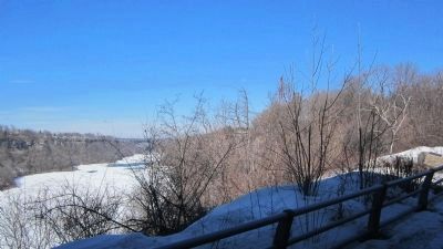
There are actually two bridges next to each other in the distance, downriver. The rust colored bridge is the Michigan Central Bridge. Since the dedication of the marker, the Michigan Central Bridge is no longer in use. It was built wide enough to carry two tracks. Canadian Pacific Railway (CP) sold their active right of way to the bridge to the City of Niagara Falls, Ontario, which had long sought to banish the CP from running freight trains through the dense tourist area. The gray colored bridge behind the Michigan Central is the Whirlpool Rapids Bridge, owned by the Niagara Falls Bridge Commission, and restricted to NEXUS member travelers. The upper deck of the Whirlpool Bridge is a rail crossing recently bought by Amtrak from Canadian National Railway (CN) which had filed to abandon it. CN uses the International Railway Bridge in Buffalo to cross the Niagara River, and CP negotiated trackage rights over the International Railway Bridge before it could abandon the Michigan Central Bridge and sell the right of way on the Canadian side.
Lithograph by Charles Parsons, via US Library of Congress, 1856
7. The 1855 Suspension Bridge
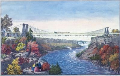
This hand-colored lithograph of the Niagara Suspension Bridge shows the Niagara Falls in the background and the Maid of the Mist in the waters below. The architecture of the bridge is clearly visible. The 822 foot bridge, 240 feet above water level, stood until 1897. Three railway lines used the bridge: The Great Western Railway (Canadian), The New York Central Railroad (U.S.), and the New York and Erie Railroad (U.S). Click on image to enlarge.
Credits. This page was last revised on March 11, 2021. It was originally submitted on March 17, 2014, by Anton Schwarzmueller of Wilson, New York. This page has been viewed 977 times since then and 39 times this year. It was the Marker of the Week March 7, 2021. Photos: 1, 2, 3, 4, 5, 6. submitted on March 17, 2014, by Anton Schwarzmueller of Wilson, New York. 7. submitted on March 6, 2021, by J. J. Prats of Powell, Ohio. • Bill Pfingsten was the editor who published this page.
