Anna Maria in Manatee County, Florida — The American South (South Atlantic)
“Bean's Point” / Early Legend
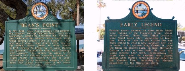
In May 1894, Anna Maria Island's first modern-day pioneer -- George Emerson Bean -- took up a homestead, signed by President Wm. McKinley, that embraced the island's entire north point. Other daring settlers, such as Samuel C. Cobb and John R. Jones, came shortly after, clearing the island's dense jungle to build homes. In 1913, George W. Bean, son of Anna Maria's first pioneer, founded the Anna Maria Development Company. This opened the island to its expansion as a uniquely appealing summer and winter resort for visitors as well as year round home for an increasing number of residents from almost every state of the union.
Reverse:
Earliest known dwellers of Anna Maria Island were Indians of the Timucuan Tribe, whose burial mounds, filled with tribal artifacts, were found years later. According to tradition, Ponce de Leon in 1513 visited this key (then joined to what is now Longboat Key) and in honor of his sponsor King Charles II, gave the island his queen's name. In 1539, Hernando DeSoto is said to have made his first new world landing near here. Replenishing his ships' water casks, the explorer then passed around Anna Maria's north point and sailed to the Manatee River, launching his historic expedition to the Mississippi River.
Erected 1969 by Florida Board of Parks and Historic Memorials in cooperation with Manatee County Historical Society. (Marker Number F-171.)
Topics. This historical marker is listed in these topic lists: Exploration • Native Americans • Settlements & Settlers. A significant historical month for this entry is May 1894.
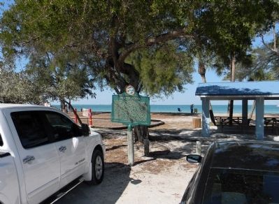
Location. 27° 32.101′ N, 82° 44.172′ W. Marker is in Anna Maria, Florida, in Manatee County. Marker is on North Bay Boulevard, 0.3 miles north of Pine Avenue, on the right when traveling north. The marker is located between the street side parking and the Bayfront Park picnic area. Touch for map. Marker is at or near this postal address: 316 North Bay Boulevard, Anna Maria FL 34216, United States of America. Touch for directions.
Other nearby markers. At least 8 other markers are within walking distance of this marker. Passage Key (within shouting distance of this marker); The Anna Maria Pier (approx. 0.3 miles away); Historic Anna Maria City Pier (approx. 0.3 miles away); Anna Maria City Pier ... Then and Now (approx. 0.4 miles away); The Historic Cottages of Pine Avenue (approx. 0.4 miles away); The Homes on the End of the Pier (approx. 0.4 miles away); The Old City Jail (approx. 0.4 miles away); The City of Anna Maria Historical Park (approx. 0.4 miles away). Touch for a list and map of all markers in Anna Maria.
Credits. This page was last revised on October 23, 2017. It was originally submitted on March 19, 2014, by PaulwC3 of Northern, Virginia. This page has been viewed 699 times since then and 64 times this year. Photos: 1, 2. submitted on March 20, 2014, by PaulwC3 of Northern, Virginia.

