East Village in Long Beach in Los Angeles County, California — The American West (Pacific Coastal)
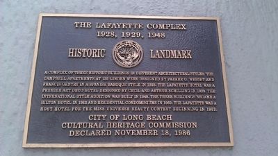
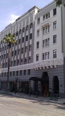
The Lafayette Complex
1928, 1929, 1948
Erected 1986 by City of Long Beach Cultural Heritage Commission.
Topics and series. This historical marker is listed in these topic lists: Architecture • Landmarks. In addition, it is included in the Art Deco series list. A significant historical year for this entry is 1928.
Location. 33° 46.134′ N, 118° 11.158′ W. Marker is in Long Beach, California, in Los Angeles County. It is in East Village. Marker is on Linden Avenue, on the right when traveling north. Touch for map. Marker is at or near this postal address: 140 Linden Ave, Long Beach CA 90802, United States of America. Touch for directions.
Other nearby markers. At least 8 other markers are within walking distance of this marker. The Campbell Mural (here, next to this marker); The Broadlind Hotel (within shouting distance of this marker); Cooper Arms (about 700 feet away, measured in a direct line); Long Beach Post Office (approx. ¼ mile away); Grand Army of the Republic Highway (approx. ¼ mile away); Ranchos (approx. ¼ mile away); Long Beach Skating Rink (approx. ¼ mile away); Long Beach Unity Society of Practical Christianity Church (approx. ¼ mile away). Touch for a list and map of all markers in Long Beach.
Credits. This page was last revised on May 25, 2023. It was originally submitted on March 20, 2014, by Michael Kindig of Elk Grove, California. This page has been viewed 671 times since then and 28 times this year. Photos: 1, 2. submitted on March 20, 2014, by Michael Kindig of Elk Grove, California. • Syd Whittle was the editor who published this page.

