Near Captain Cook in Hawaii County, Hawaii — Hawaiian Island Archipelago (Pacific Ocean)
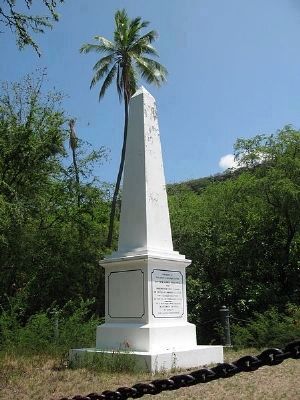
In Memory of Captain James Cook, R.N.
Marker panel on obelisk (1874):
the great circumnavigator
Captain James Cook, R.N.
who discovered these islands
on the 18th of January, 1770
and fell near this spot
on the 14th of February, 1779.
----------------------
This monument was erected
in November A.D. 1874
by some of
his fellow countrymen.
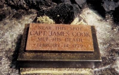
Second Marker:
Capt. James Cook
met his death
February 14, 1779
Erected 1874 by "Some of his fellow countrymen".
Topics. This historical marker is listed in these topic lists: Colonial Era • Exploration • Waterways & Vessels. A significant historical date for this entry is January 18, 1770.
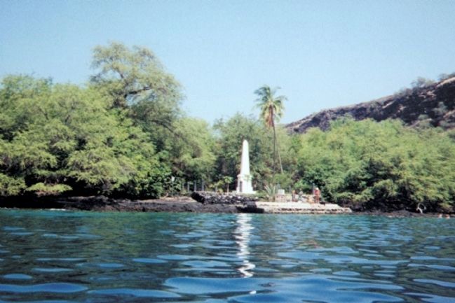
Location. 19° 28.878′ N, 155° 56.006′ W. Marker is near Captain Cook, Hawaii, in Hawaii County. Marker can be reached from Kealakekua Bay. The Cook Memorial can only be accessed by land (on foot or horseback) via steep, unpaved mountainside trails - southeast from the community of Captain Cook, HI. and west from Mamalahoa Hwy. (HI-11); or via water (kayak or boat) from Kealakekua Bay. Touch for map. Marker is in this post office area: Captain Cook HI 96704, United States of America. Touch for directions.
Other nearby markers. At least 8 other markers are within 6 miles of this marker, measured as the crow flies . First Christian Service in Hawaii (approx. one mile away); Greenwell Store (approx. 2.2 miles away); Pu‘uhona O Hōnaunau - Place of Refuge (approx. 4.4 miles away); Royal Center at Keauhou Bay (approx. 5.8 miles away); The Kamehameha Dynasty (approx. 5.8 miles away); Kauikeaouli and Nāhi'ena'ena (approx. 5.8 miles away); Keauhou Bay (approx. 5.9 miles away); Birthplace of Kauikeaouli (approx. 5.9 miles away).
More about this marker. The marker is in poor condition, ravaged by the effects of weather and salt water over the years. However, it is a magnificent location for snorkeling and well worth the effort.
Related markers. Click here for a list of markers that are related to this marker.
Also see . . .
1. Captain James Cook was a Man of Great Ambition. His life’s goal, the famed voyager once wrote, was to journey not only “further than any man has been before me, but as far as I think it possible for man to go.” (Submitted on October 4, 2012, by Cosmos Mariner of Cape Canaveral, Florida.)
2. Kealakekua Bay - Wikipedia Article. Kealakekua Bay is located on the Kona coast of the island of Hawaiʻi about 12 miles (19 km) south of Kailua-Kona. Settled over a thousand years ago, the surrounding
Photographed By Cosmos Mariner, April 22, 1998
2. Captain James Cook Marker
This polished granite "tombstone-like" marker is located at the approximate site of Captain Cook's death. It is on the beach were Cook came ashore on February 14, 1779. It is clearly visible at low tide but sometimes underwater at high tide.
Additional keywords. Native Hawaiian Polynesians; Kealakekua Bay State Historical Park
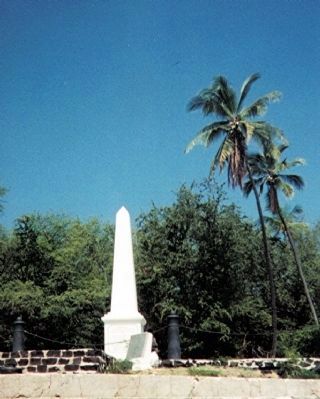
Photographed By Cosmos Mariner, April 22, 1998
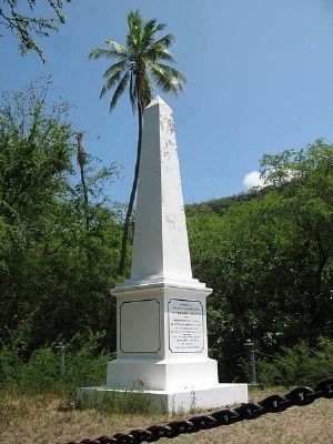
5. Captain James Cook Memorial Marker
The large white stone monument was built in 1874 on the order of Princess Likelike and was deeded to the United Kingdom in 1877. The chain around the monument is supported by four cannon from the ship HMS Fantome placed with their breaches embedded in the rock in 1876.
Credits. This page was last revised on October 15, 2020. It was originally submitted on October 4, 2012, by Cosmos Mariner of Cape Canaveral, Florida. This page has been viewed 1,895 times since then and 102 times this year. Last updated on March 22, 2014, by Richard E. Miller of Oxon Hill, Maryland. Photos: 1. submitted on March 1, 2014, by Richard E. Miller of Oxon Hill, Maryland. 2, 3. submitted on October 4, 2012, by Cosmos Mariner of Cape Canaveral, Florida. 4. submitted on March 1, 2014, by Richard E. Miller of Oxon Hill, Maryland. 5. submitted on October 4, 2012, by Cosmos Mariner of Cape Canaveral, Florida. • Bill Pfingsten was the editor who published this page.
