Schenectady in Schenectady County, New York — The American Northeast (Mid-Atlantic)
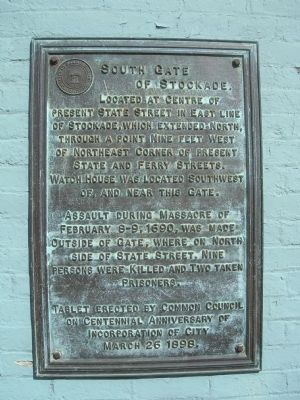
South Gate of Stockade
present State Street in east line
of stockade, which extended north,
through a point nine feet west
of northeast corner of present
State and Ferry Streets.
Watch house was located southwest
of, and near this gate.
Assault during massacre of
February 8-9, 1690, was made
outside of gate, where on north
side of State Street, nine
persons were killed and two taken
prisoners.
Tablet erected by Common Council
on centennial anniversary of
incorporation of city
March 26 1898.
Erected 1898 by Schenectady Common Council.
Topics. This historical marker is listed in these topic lists: Colonial Era • Notable Places • Settlements & Settlers. A significant historical month for this entry is February 1735.
Location. 42° 48.903′ N, 73° 56.759′ W. Marker is in Schenectady, New York, in Schenectady County. Marker is at the intersection of South Ferry Street and State Street (New York State Route 5), on the right when traveling north on South Ferry Street. Touch for map. Marker is at or near this postal address: 201 State St, Schenectady NY 12305, United States of America. Touch for directions.
Other nearby markers. At least 8 other markers are within walking distance of this marker. The King’s Highway (a few steps from this marker); First Mill (about 300 feet away, measured in a direct line); Schenectady (about 400 feet away); Yates House (about 600 feet away); Dutch Church (about 700 feet away); Second Site of Dutch Church (about 700 feet away); M-7 Day (about 700 feet away); Southwest Corner of Stockade (about 700 feet away). Touch for a list and map of all markers in Schenectady.
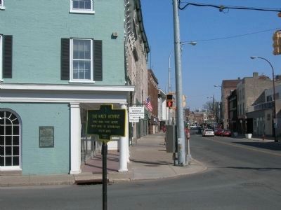
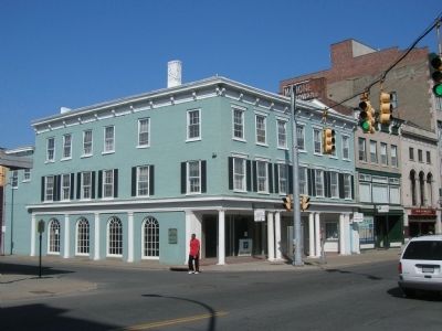
More about this marker. The Marker is mounted on the side of the brick building at the northeast corner of the intersection of State Street (Route 5) and the side street, South Ferry Street, in down town Schenectady. The marker faces South Ferry Street.
Regarding South Gate of Stockade. The Schenectady Stockade received patent in 1672. The village was divided into four blocks, or squares, and these were subdivided into house-lots. The entire area of the village was enclosed and fortified with stockades, or palisades. It was patented as a township with certain municipal rights in 1684. At various times in its early history, Schenectady suffered from the attacks of the French and the Indians. The most memorable of
these attacks known as "The Massacre of Schenectady". was in February, 1690. Schenectady is said to have had at this time about 80 houses and 400 inhabitants, of which 60 were killed, 27 made prisoners, and the village burned. The village was protected by palisades. There were two gates, one at the north end of Church street, the other at the south end, opening out to the Albany road. There was, also, near what is now the corner of Washington and Front streets, a fort garrisoned by 24 men.
Additional keywords. Massacre of 1690
Credits. This page was last revised on June 16, 2016. It was originally submitted on April 21, 2008, by Howard C. Ohlhous of Duanesburg, New York. This page has been viewed 2,151 times since then and 25 times this year. Photos: 1, 2, 3. submitted on April 21, 2008, by Howard C. Ohlhous of Duanesburg, New York. • Kevin W. was the editor who published this page.


