Okeechobee in Okeechobee County, Florida — The American South (South Atlantic)
Okeechobee County
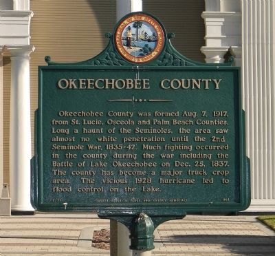
Okeechobee County was formed Aug. 7, 1917, from St. Lucie, Osceola and Palm Beach Counties. Long a haunt of the Seminoles, the area saw almost no white penetration until the 2nd Seminole War, 1835-42. Much fighting occurred in the county during the war including the Battle of Lake Okeechobee on Dec. 25, 1837. The county has become a major truck crop area. The vicious 1928 hurricane led to flood control on the Lake.
Erected 1961 by Florida Board of Parks and Historic Memorials. (Marker Number F-59.)
Topics. This historical marker is listed in this topic list: Political Subdivisions. A significant historical date for this entry is August 7, 1941.
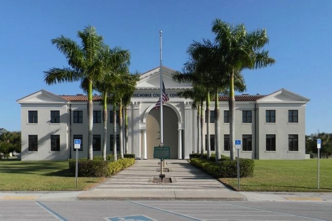
Location. 27° 14.697′ N, 80° 49.967′ W. Marker is in Okeechobee, Florida, in Okeechobee County. Marker is on Northwest 2nd St west of Northwest 3rd Avenue, on the right when traveling west. Touch for map. Marker is at or near this postal address: 304 Northwest 2nd St, Okeechobee FL 34972, United States of America. Touch for directions.
Other nearby markers. At least 8 other markers are within 4 miles of this marker, measured as the crow flies. First United Methodist Church of Okeechobee, Florida (about 400 feet away, measured in a direct line); Richard E. Hamrick (about 700 feet away); For All Who Have Served (approx. 0.2 miles away); Vietnam Pilots and Crewmembers Memorial (approx. 0.2 miles away); Peter and Louisiana Chandler Raulerson Log Cabin Historic Site (approx. 0.7 miles away); Tantie School House #14 (approx. 2 miles away); Peter And Louisiana Chandler Raulerson Gravesite (approx. 3 miles away); The Battle of Okeechobee (approx. 3˝ miles away). Touch for a list and map of all markers in Okeechobee.
Credits. This page was last revised on May 9, 2021. It was originally submitted on March 25, 2014, by PaulwC3 of Northern, Virginia. This page has been viewed 861 times since then and 20 times this year. Last updated on March 25, 2014, by Tim Fillmon of Webster, Florida. Photos: 1, 2, 3, 4. submitted on March 25, 2014, by PaulwC3 of Northern, Virginia. • Bernard Fisher was the editor who published this page.


