Sharpsburg in Washington County, Maryland — The American Northeast (Mid-Atlantic)
Evans' Brigade, Longstreet's Command
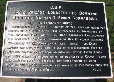
Evans' Brigade, Longstreet's Command.
Brig. Gen. Nathan G. Evans, Commanding.
(September 17, 1862.)
Evans' Brigade continued in support of the artillery during the morning of the 17th, covering the approaches to Sharpsburg by the Boonsboro Pike. At 7:30 a.m. Geo. T. Anderson's Brigade, which had been under temporary command of Gen. Evans, was detached and ordered to the Confederate left. About 1 p.m. Evans' Brigade was deployed on both sides of the Boonsboro Pike to meet the advance of the regular infantry of the Fifth Corps. At about 3 p.m. this brigade, with the remnants of Colquitt's and Garland's Brigades of D.H. Hill's Division, co-operated with D.R. Jones' Division in resisting the advance of the enemy from the direction of the Middle Bridge.
Erected by Antietam Battlefield Board. (Marker Number 313.)
Topics and series. This historical marker is listed in this topic list: War, US Civil. In addition, it is included in the Antietam Campaign War Department Markers series list. A significant historical year for this entry is 1862.
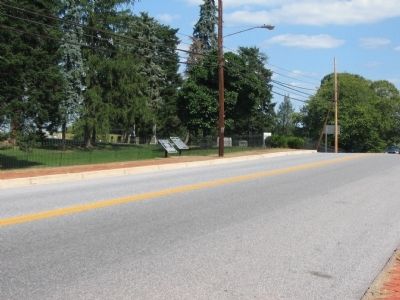
Location. 39° 27.615′ N, 77° 44.53′ W. Marker is in Sharpsburg, Maryland, in Washington County. Marker is on Boonsboro Pike (State Highway 34), on the right when traveling west. Located on the opposite side of the highway from the National Cemetery, stop eleven of the driving tour of Antietam Battlefield. Touch for map. Marker is in this post office area: Sharpsburg MD 21782, United States of America. Touch for directions.
Other nearby markers. At least 8 other markers are within walking distance of this marker. A different marker also named Evans' Brigade, Longstreet's Command (here, next to this marker); Washington Artillery, Longstreet's Command (a few steps from this marker); a different marker also named Washington Artillery, Longstreet's Command (within shouting distance of this marker); Longstreet's Command (within shouting distance of this marker); a different marker also named Longstreet's Command (within shouting distance of this marker); Reserve Artillery, Longstreet's Command (within shouting distance of this marker); Hood's Division, Longstreet's Command (within shouting distance of this marker); a different marker also named Longstreet's Command (within shouting distance of this marker). Touch for a list and map of all markers in Sharpsburg.
Also see . . .
1. Antietam Battlefield. National Park Service site. (Submitted on April 22, 2008, by Craig Swain of Leesburg, Virginia.)
2. Evans' Independent Brigade, Longstreet's Command. Evidence of the critical state in the Confederate center after the collapse of the Sunken Lane sector comes from Evans'
official report: I was ordered to rally the troops then flocking to the town from our [left] and bring them into action. After considerable exerting, with the assistance of my entire staff, I succeeded in collecting about 250 men and officers, whom I formed into two commands, and placed them, respectively, under the command of Colonels Colquitt and Iverson, of Major General D. H. Hill's division....This little command gallantly drove the enemy from his cover in the corn-field and caused him to retreat in confusion, leaving a number of their dead and two stand of colors, the latter having been shot down by a well-directed fire of Captain Boyce's battery. (Submitted on April 22, 2008, by Craig Swain of Leesburg, Virginia.)

Photographed By Craig Swain, April 6, 2008
3. 17th S.C. and Holcombe Legion Position
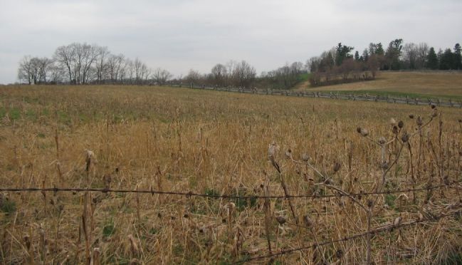
From about 1 p.m. until just after 3 p.m. the 17th South Carolina and the Holcombe Legion of Evans' Brigade held a position along the Sherrick farm lane, just south of the Boonsboro Pike. They were driven back by the advance of the U.S. Regular Infantry regiments. This view is from a stone wall, about 100 yards east of Rodman Avenue. The 50th Pennsylvania Regiment monument can be seen on the left. The south edge of the National Cemetery wall on the right.

Photographed By Craig Swain
4. Evans' Brigade and Jones' Battalion Position
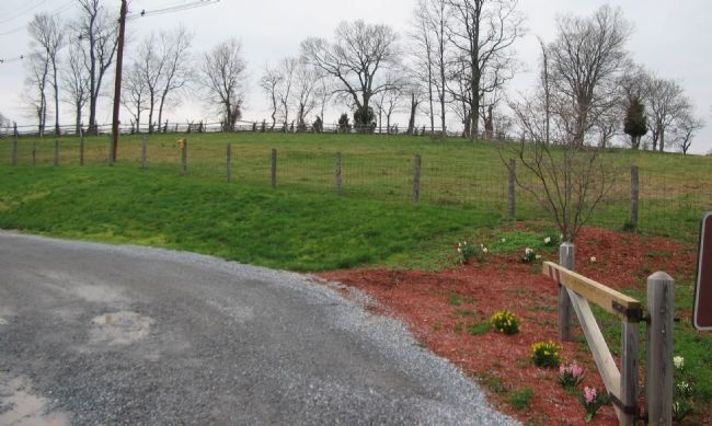
Artillery batteries from Jones' Battalion covered the Boonsboro Pike from the high ground here, to the north of the National Cemetery. Evans' Brigade of infantry supported these batteries throughout the day with skirmish lines set on the forward edge of the crest.
Credits. This page was last revised on September 29, 2017. It was originally submitted on April 22, 2008, by Craig Swain of Leesburg, Virginia. This page has been viewed 1,005 times since then and 16 times this year. Photos: 1. submitted on April 22, 2008, by Craig Swain of Leesburg, Virginia. 2. submitted on April 21, 2008, by Craig Swain of Leesburg, Virginia. 3, 4. submitted on April 22, 2008, by Craig Swain of Leesburg, Virginia.

