Price in Carbon County, Utah — The American Mountains (Southwest)
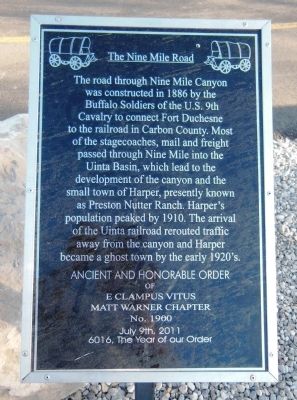
The Nine Mile Road
The road through Nine Mile Canyon was constructed in 1886 by the Buffalo Soldiers of the U.S. 9th Cavalry to connect Fort Duchesne to the railroad in Carbon County. Most of the stagecoaches, mail and freight passed through Nine Mile into the Uintah Basin, which lead to the development of the canyon and the small town of Harper, presently known as Preston Nutter Ranch. Harper’s population peaked by 1910. The arrival of the Uinta railroad rerouted traffic away from the canyon and Harper became a ghost town by the early 1920’s.
Erected 2011 by Ancient and Honorable Order of E Clampus Vitus, Matt Warner Chapter. (Marker Number 1900.)
Topics and series. This historical marker is listed in these topic lists: Native Americans • Railroads & Streetcars • Roads & Vehicles • Settlements & Settlers. In addition, it is included in the Buffalo Soldiers, and the E Clampus Vitus series lists. A significant historical month for this entry is July 1535.
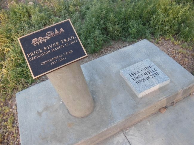
Location. 39° 35.374′ N, 110° 48.769′ W. Marker is in Price, Utah, in Carbon County. Marker is located near the Price River Trail trailhead parking lot. The trailhead parking lot is on the south side of West 6th Street, just west of the intersection with South Carbon Avenue. Touch for map. Marker is in this post office area: Price UT 84501, United States of America. Touch for directions.
Other nearby markers. At least 8 other markers are within walking distance of this marker. Abraham Powell 1877 Cabin (within shouting distance of this marker); Assumption Greek Orthodox Church (approx. 0.7 miles away); Star Theatre (approx. 0.7 miles away); Carbon Tabernacle (approx. ¾ mile away); First Meeting House (approx. ¾ mile away); Price Municipal Building (approx. ¾ mile away); Harding School (approx. 0.8 miles away); Notre Dame de Lourdes Catholic Church (approx. 0.9 miles away). Touch for a list and map of all markers in Price.
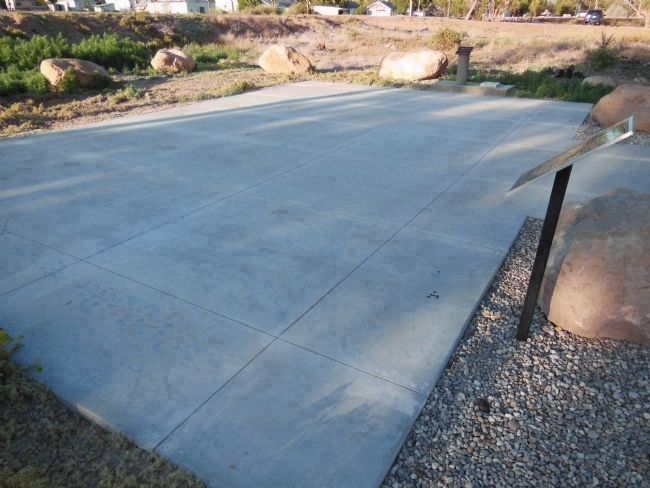
More about this marker. The marker is at the entrance to a large concrete pad, about 20ft X 30ft, adjacent to the Price River Trail. The pad is only about 80 feet south of West 6th Street, but the marker is too small and low to be seen clearly from that distance.
Also see . . .
1. Nine-Mile Canyon. Utah website entry:
Nine-Mile Canyon is an outdoor museum. It has some remarkable examples of Indian art and remnants of dwellings that have remained untouched through the centuries. Because of the dry climate and isolation from large population centers or heavy ranching, the canyon remains much as it was hundreds of years ago. The panels of rock art are of such remarkable quality and beauty that they have been featured in National Geographic and other publications highlighting the beauty and uniqueness of the art. (Submitted on April 2, 2014, by Cosmos Mariner of Cape Canaveral, Florida.)

Photographed By Cosmos Mariner, June 14, 2013
2. The Nine Mile Road Marker (side view)
The marker faces a large concrete pad, perhaps used for picnic gatherings or meetings. West 6th Street is about 80 feet north of this pad (beyond the left side of this image), and the Price River Trail trailhead parking lot is a short distance east of the pad (visible beyond the upper right corner of this image).
2. Nine Mile Canyon. Climb Utah website entry:
In the early development of the Uintah Basin of Utah, no road was more important than the Price-Myton road which runs through Nine Mile and Gate Canyons. The road was carved through the rugged canyon by the all-black 9th Cavalry. Nine Mile Road construction coincided with the building of Fort Duchesne on the Uintah frontier in 1886. The road was needed to supply the 300 soldiers garrisoned at Fort Duchesne. Following Indian trails, the road linked the fort with the nearest railhead in Price. For the next quarter-century, the road was the most heavily traveled in eastern Utah. It was the main route for stagecoach, mail, freight and telegraph into Uintah Basin. It was a six-day journey by wagon from Price to Fort Duchesne. (Submitted on April 2, 2014, by Cosmos Mariner of Cape Canaveral, Florida.)
Credits. This page was last revised on August 28, 2023. It was originally submitted on April 1, 2014, by Cosmos Mariner of Cape Canaveral, Florida. This page has been viewed 774 times since then and 21 times this year. Photos: 1. submitted on April 1, 2014, by Cosmos Mariner of Cape Canaveral, Florida. 2, 3. submitted on April 2, 2014, by Cosmos Mariner of Cape Canaveral, Florida. • Bill Pfingsten was the editor who published this page.

