Near Locust Grove in Orange County, Virginia — The American South (Mid-Atlantic)
The Confederate Line
The Battle of the Wilderness
Inscription.
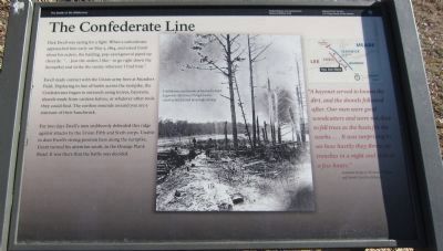
Dick Ewell was raring for a fight. When a subordinate approached him early on May 5, 1864, and asked Ewell about his orders, the balding, pop-eyed general piped up cheerily: "... Just the orders I like - to go right down the [turnpike] and strike the enemy wherever I find him."
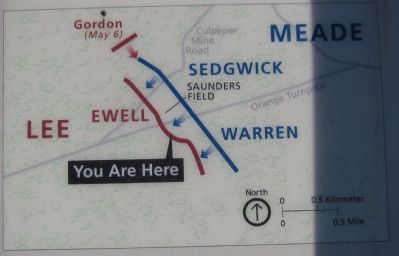
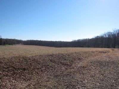
Ewell made contact with the Union army here at Saunders Field. Deploying in line of battle across the turnpike, the Confederates began to entrench using knives, bayonets, shovels made from canteen halves, or whatever other tools they could find. The earthen mounds around you are a remnant of their handiwork.
For two days Ewell's men stubbornly defended this ridge against attacks by the Union Fifth and Sixth corps. Unable to dent Ewell's strong position here along the turnpike, Grant turned his attention south, to the Orange Plank Road. It was there that the battle was decided.
"A bayonet served to loosen the dirt, and the shovels followed after. Our men were good woodcutters and were not slow to fell trees as the basis for the works .... It was surprising to see how hastily they threw up trenches in a night and even in a few hours." - Assistant Surgeon Thomas F. Wood, 3rd North Carolina Infantry
Erected by Fredericksburg-Spotsylvania National Military Park - National Park Service - U.S. Department of the Interior.
Topics. This historical marker is listed in this topic list: War, US Civil. A significant historical month for this entry is May 1875.
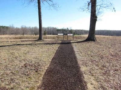
Location. 38° 18.963′ N, 77° 45.548′ W. Marker is near Locust Grove, Virginia, in Orange County. Marker is on Hill-Ewell Drive, on the left when traveling south. The marker is in the Wilderness Battlefield, at Stop Three (Saunders Field) on the driving tour of the battlefield. Touch for map. Marker is in this post office area: Locust Grove VA 22508, United States of America. Touch for directions.
Other nearby markers. At least 8 other markers are within walking distance of this marker. “A Wild, Wicked Roar” (here, next to this marker); Battle of the Wilderness (a few steps from this marker); a different marker also named "A Wild, Wicked Roar" (about 400 feet away, measured in a direct line); The Confederate Defense (about 400 feet away); 140th New York State Vols. (about 700 feet away); First Blood in Saunders Field (approx. 0.2 miles away); Gordon Flank Attack Trail (approx. 0.2 miles away); a different marker also named The Battle of the Wilderness (approx. 0.2 miles away). Touch for a list and map of all markers in Locust Grove.
Also see . . . Battle of the Wilderness. NPS page with information on the battle. (Submitted on April 7, 2014, by Craig Swain of Leesburg, Virginia.)
Credits. This page was last revised on June 16, 2016. It was originally submitted on April 7, 2014, by Craig Swain of Leesburg, Virginia. This page has been viewed 552 times since then and 11 times this year. Photos: 1, 2, 3, 4. submitted on April 7, 2014, by Craig Swain of Leesburg, Virginia.


