Niagara Falls in Niagara County, New York — The American Northeast (Mid-Atlantic)
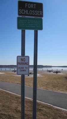
Fort Schlosser
Guarding the Upper Landing
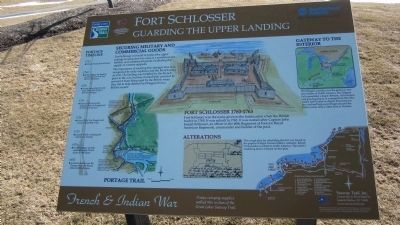
Securing Military and Commercial Goods.
Fort Schlosser was built to protect the upper portage landing and was used as a storehouse for military and commercial goods, facilitating the supply of western outposts.
The importance of securing this strategic area was recognized by early explorers and the French army as well. The landing was fortified by the French prior to the war, but they burned their own fort to prevent it from being used by the British when they left to help defend Fort Niagara from a British assault.
LOWER LANDING
Goods and boats had to be carried from here up the 310 foot vertical rise to the upper landing.
UPPER LANDING
Boats landed and departed from this point before entering the rapids above the falls.
FORT LITTLE NIAGARA
Fort Little Niagara (Fort du Portage) was built by French officer and merchant Daniel-Marie Chabert de Joncaire to prevent western American Indians from slipping past Fort Niagara to trade with the British as Fort Oswego.
FORT SCHLOSSER
1760-1763. Fort Schlosser was the name given to the fortification when the British it in 1760. It was rebuilt in 1763. It was named after Captain John Joseph Schlosser, an officer in the 60th Regiment of Foot (or Royal American Regiment), commander and builder of the post.
ALTERATIONS
This rough plan for rebuilding the fort was found in the papers of Major Jeffery Amherst, British Commander-in-Chief in North America. The artist's rendering above is based on this plan.
GATEWAY TO THE INTERIOR
The Niagara corridor was the gateway into the interior of North America, but Niagara Falls presented a major obstacle. All travelers and goods going to or coming from the Ohio Valley had to land or depart from here for the overland bypass (portage) around the Falls to enter either Lakes Erie or Ontario.
PORTAGE TIMELINE
1763 British rebuild Fort Schlosser.
1760 British occupy the landing and build a new fort they call Fort Schlosser.
1759 French forces abandon and burn Fort Little Niagara (Fort du Portage).
1751 French build Fort Little Niagara (Fort du Portage), just downriver from here.
1726 French build Fort Niagara and occupy the portage route.
1720 Joncaire builds a trading post at the lower landing.
1679 French explorer La Salle establishes early French claims to the region.
1650 American Indians use the portage route, the Seneca tribe controls the area. French & Indian War. Troops carrying supplies walked this section of the Seaway Trail.
Seaway Trail, Inc. Corner Ray & West Mail St., Sackets Harbor, NY 13685. www.seawaytrail.com . This project was funded in part by the Federal Highway Administration and administered by the New York State Scenic Byways Program of the New York State Department of Transportation and Seaway Trail, Inc.
Erected by Seaway Trail, Inc.
Topics and series. This historical marker is listed in these topic lists: Forts and Castles • War of 1812 • War, French and Indian. In addition, it is included in the Great Lakes Seaway Trail National Scenic Byway series list. A significant historical year for this entry is 1760.
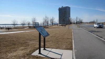
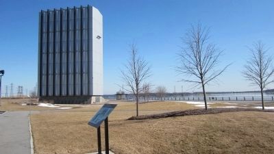
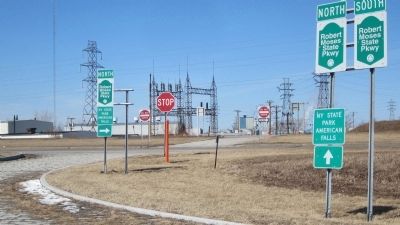
Location. 43° 4.649′ N, 79° 0.912′ W. Marker is in Niagara Falls, New York, in Niagara County. Marker can be reached from Niagara Scenic Parkway (New York State Route 957A) one mile west of Interstate 190, on the left when traveling north. The Marker, and the Great Cataract of Niagara marker, are located at a scenic overlook of the upper Niagara River where the two New York State Power Authority water intake portal gates are located. The gates are housed in towers. The overlook is accessible by car only from the parkway. The parkway divider is cut to allow traffic to cross to and from the overlook area. Though marked north-south, this stretch of the parkway is compass east-west. Touch for map. Marker is in this post office area: Niagara Falls NY 14304, United States of America. Touch for directions.
Other nearby markers. At least 8 other markers are within 2 miles of this marker, measured as the
crow flies. The Great Cataract of Niagara (about 300 feet away, measured in a direct line); Portage Road (approx. 1.4 miles away); Niagara Falls Veterans Memorial (approx. 1.4 miles away); The Niagara River Portage and the Old Stone Chimney (approx. 1˝ miles away); Historic Falls Portage (approx. 1˝ miles away); Old Stone Chimney (approx. 1˝ miles away); Thomas V. Welch (approx. 1.6 miles away); Holy Trinity Roman Catholic Church Complex (approx. 1.6 miles away). Touch for a list and map of all markers in Niagara Falls.
More about this marker. GPS coordinates are on the Niagara Scenic Parkway by the overlook area.
Also see . . . Fort Schlosser - Wikipedia. (Submitted on April 7, 2014, by Anton Schwarzmueller of Wilson, New York.)
Credits. This page was last revised on June 27, 2023. It was originally submitted on April 7, 2014, by Anton Schwarzmueller of Wilson, New York. This page has been viewed 1,665 times since then and 181 times this year. Last updated on June 24, 2023, by Trevor L Whited of Kokomo, Indiana. Photos: 1, 2, 3, 4, 5, 6. submitted on April 7, 2014, by Anton Schwarzmueller of Wilson, New York. • Michael Herrick was the editor who published this page.
