Michigan City in LaPorte County, Indiana — The American Midwest (Great Lakes)
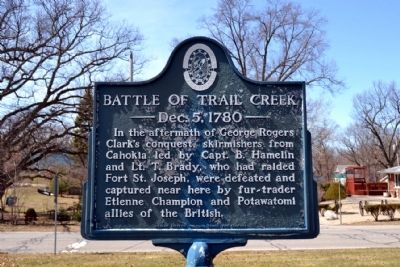
Battle of Trail Creek
— Dec. 5, 1780 —
Erected by Indiana Society, Colonial Dames XVII Century.
Topics and series. This historical marker is listed in these topic lists: Native Americans • War, US Revolutionary. In addition, it is included in the The Colonial Dames XVII Century, National Society series list.
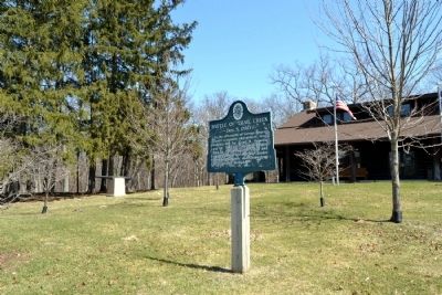
Location. 41° 43.136′ N, 86° 52.407′ W. Marker is in Michigan City, Indiana, in LaPorte County. Marker is at the intersection of Liberty Trail and E. 8th Street, on the right when traveling north on Liberty Trail. Marker is located in front of the park hall in Krueger Memorial Park. Touch for map. Marker is at or near this postal address: 801 Liberty Trail, Michigan City IN 46360, United States of America. Touch for directions.
Other nearby markers. At least 8 other markers are within 2 miles of this marker, measured as the crow flies. Camp Anderson (approx. 0.7 miles away); Michigan City Civil War Memorial (approx. 1.1 miles away); Michigan City World War II Memorial (approx. 1.2 miles away); Saint Stanislaus Cemetery World War II Memorial (approx. 1.2 miles away); Elston Grove Historic District (approx. 1.3 miles away); Naomi Anderson (approx. 1.3 miles away); Charles R. Westcott (approx. 1.3 miles away); Barker Mansion (approx. 1.4 miles away). Touch for a list and map of all markers in Michigan City.
Credits. This page was last revised on June 16, 2016. It was originally submitted on April 8, 2014, by Duane Hall of Abilene, Texas. This page has been viewed 1,698 times since then and 70 times this year. Photos: 1, 2, 3, 4. submitted on April 8, 2014, by Duane Hall of Abilene, Texas.


