Near Fairfax in Nicollet County, Minnesota — The American Midwest (Upper Plains)
Fort Ridgely Closes
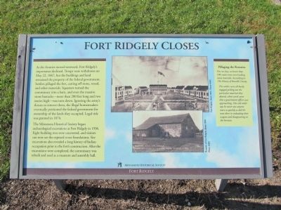
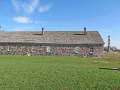
As the frontier moved westward, Fort Ridgely's importance declined. Troops were withdrawn on May 22, 1867, but the buildings and land remained the property of the federal government. Settlers pillaged the fort, carting off stone, wood, and other materials. Squatters turned the commissary into a barn, and even the massive stone barracks—more than 200 feet long and two stories high—was torn down. Ignoring the army's threats to remove them, the illegal homesteaders eventually petitioned the federal government for ownership of the lands they occupied. Legal title was granted in 1874.
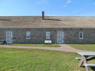
The Minnesota Historical Society began archaeological excavations at Fort Ridgely in 1936. Eight building sites were uncovered, and visitors can now see the exposed stone foundations. Site excavations also revealed a long history of Indian occupation prior to the fort's construction. After the excavations were completed, the commissary was rebuilt and used as a museum and assembly hall.
Pillaging the Remains
On one day, no fewer than 100 teams were seen hauling away materials. According to The History of Renville County,
The settlers were all busily engaged picking out the particular material they desired, when word came that a government officer was approaching. One old settler says he never saw anyone move as quickly as did the men there in unloading their wagons and disappearing on the horizon.
Fort Ridgely
Erected by the Minnesota Historical Society.
Topics and series. This historical marker is listed in this topic list: Forts and Castles. In addition, it is included in the Minnesota Historical Society series list. A significant historical month for this entry is May 1850.
Location. 44° 27.204′ N, 94° 44.078′ W. Marker is near Fairfax, Minnesota, in Nicollet County. Marker is on County Highway 30, 1.1 miles west of State Highway 4, on the right when traveling west. Marker is in Fort Ridgely State Park; fee area – a Minnesota state park vehicle permit is required. Touch for map. Marker is at or near this postal address: 72404 County State Aid Highway 30, Fairfax MN 55332, United States of America. Touch for directions.
Other nearby markers. At least 8 other markers are within walking distance of this marker. Who Lived in the Barracks? (within shouting distance of this marker); A Minority in Their Homeland / U.S.-Dakota Conflict (within shouting distance of this marker); Four Days From Fort Snelling (within shouting distance of this marker); Fort Ridgely (within shouting distance of this marker); This Fort Had a Purpose (within shouting distance
of this marker); Economic Engine (within shouting distance of this marker); Stone Barracks (within shouting distance of this marker); Reinforcements Arrive (within shouting distance of this marker). Touch for a list and map of all markers in Fairfax.
More about this marker. captions:
• Fort Ridgely, about 1864. Photo MHS
• Remains of Fort Ridgely, about 1900. Photo MHS
• Remnant of "Old Fort Ridgely" Famous Battlefield of the Sioux Indian Uprising of 1862 [H. Frank] Scobie Photo
Regarding Fort Ridgely Closes. Fort Ridgely was built in 1853 as a police station to keep peace between settlers and the Minnesota Dakota. In 1862, the Minnesota Dakota, also known by the French term, “Sioux," waged war against the United States following two years of unfulfilled treaty obligations. They killed approximately 800 settlers and soldiers, took many prisoners, and caused extensive property damage throughout the Minnesota River Valley. Fort Ridgely became one of the few military forts west of the Mississippi to withstand a direct assault. The Army abandoned the fort in 1867.
Also see . . . Forts on the Minnesota Frontier. Minnesota Military Museum PDF:
Fort Ridgely: "It was founded to protect settlers and control the Dakota (Sioux) Indians, who were transferred to a Minnesota Valley reservation in the summer of 1853. The fort played a major role in the Dakota Indian War of 1862." (Submitted on April 15, 2014.)
Credits. This page was last revised on July 13, 2023. It was originally submitted on April 15, 2014, by Keith L of Wisconsin Rapids, Wisconsin. This page has been viewed 494 times since then and 12 times this year. Photos: 1, 2, 3. submitted on April 15, 2014, by Keith L of Wisconsin Rapids, Wisconsin.


