Española in Rio Arriba County, New Mexico — The American Mountains (Southwest)
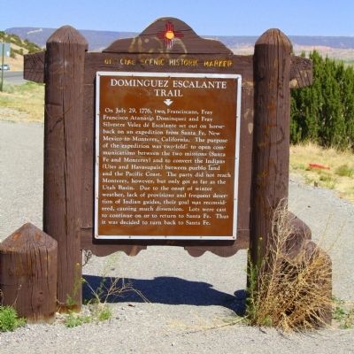
Dominguez Escalante Trail
Topics and series. This historical marker is listed in these topic lists: Colonial Era • Exploration. In addition, it is included in the Dominguez y Escalante Expedition series list. A significant historical month for this entry is July 1842.
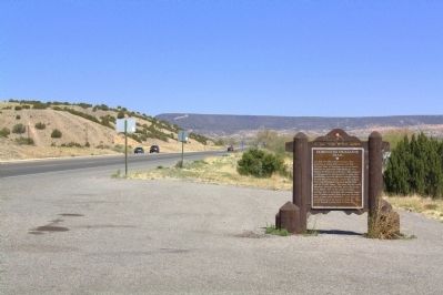
Location. 36° 1.662′ N, 106° 5.556′ W. Marker is in Española, New Mexico, in Rio Arriba County. Marker is on Chama Highway (U.S. 84 at milepost 191.1), close to Española, on the right when traveling north. Touch for map. Marker is in this post office area: Espanola NM 87532, United States of America. Touch for directions.
Other nearby markers. At least 8 other markers are within 4 miles of this marker, measured as the crow flies. Española Valley (approx. 0.9 miles away); Shrine of Our Lady of Lourdes (approx. 2.2 miles away); Esther Martinez - P’oe Tsáwäˀ (1912-2006) (approx. 2.4 miles away); San Gabriel (approx. 2.4 miles away); The Bond House (approx. 2.6 miles away); Chimayo Trading Post / Trujillo House (approx. 2.8 miles away); Santa Cruz de la Cañada / Santa Cruz Plaza on the Camino Real (approx. 3.6 miles away); Pablita Velarde, Tse Tsan, Golden Dawn (approx. 4 miles away). Touch for a list and map of all markers in Española.
Also see . . . Dominguez-Escalante Expedition. Wikipedia entry. Excerpt: “The first night of the journey they stayed overnight at the Santa Clara pueblo, north of Santa Fe, and from there they ‘traveled nine leagues, more or less, and arrived at the pueblo of Santa Rosa de Abiquiú, where because of various circumstances we remained on the 31st without traveling, and where by means of a Solemn Mass we again implored the aid of our most holy patrons’.” (Submitted on May 3, 2014.)
Additional keywords. Old Spanish Trail
Credits. This page was last revised on June 16, 2016. It was originally submitted on May 3, 2014, by J. J. Prats of Powell, Ohio. This page has been viewed 867 times since then and 32 times this year. Photos: 1, 2, 3. submitted on May 3, 2014, by J. J. Prats of Powell, Ohio.


