Winchester, Virginia — The American South (Mid-Atlantic)
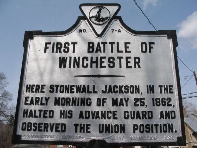
First Battle of Winchester
Erected 1928 by Conservation & Development Commission. (Marker Number A-7.)
Topics and series. This historical marker is listed in this topic list: War, US Civil. In addition, it is included in the Virginia Department of Historic Resources (DHR) series list. A significant historical date for this entry is May 25, 1838.
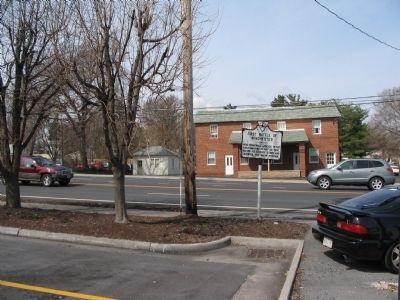
Location. 39° 9.816′ N, 78° 10.98′ W. Marker is in Winchester, Virginia. Marker is on Valley Avenue (U.S. 11). Touch for map. Marker is at or near this postal address: 2120 Valley Avenue, Winchester VA 22601, United States of America. Touch for directions.
Other nearby markers. At least 8 other markers are within 2 miles of this marker, measured as the crow flies. 1st Battle of Winchester (about 600 feet away, measured in a direct line); a different marker also named First Battle of Winchester (approx. 0.4 miles away); Welcome to a Special Place (approx. 0.9 miles away); a different marker also named First Battle of Winchester (approx. one mile away); The Hollingsworth Family Settlement (approx. 1.2 miles away); Abram’s Delight (approx. 1.2 miles away); Shawnee Springs Hospital (approx. 1.2 miles away); a different marker also named Abram’s Delight (approx. 1.3 miles away). Touch for a list and map of all markers in Winchester.

Photographed By Craig Swain, March 15, 2008
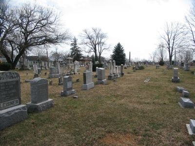
3. Camp Hill
Located along Kent Street in the southwestern part of Winchester, this cemetery now covers the site of Camp Hill. Federal troops formed a defensive line here in the middle phase of the battle. Occupying this line were the 46th Pennsylvania, 5th Connecticut and 28th New York Infantry Regiments.
Credits. This page was last revised on July 14, 2021. It was originally submitted on April 25, 2008, by Craig Swain of Leesburg, Virginia. This page has been viewed 1,716 times since then and 59 times this year. Photos: 1, 2, 3. submitted on April 25, 2008, by Craig Swain of Leesburg, Virginia.

