Marker Logo HMdb.org THE HISTORICAL
MARKER DATABASE
“Bite-Size Bits of Local, National, and Global History”
Near Ropesville in Hockley County, Texas — The American South (West South Central)
 

Site of Primrose School

About One-Half Mile Southwest


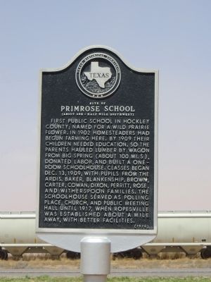
Site of Primrose School Marker image. Click for full size.
Photographed By Bill Kirchner, April 28, 2014
1. Site of Primrose School Marker
Inscription. First public school in Hockley County; named for a wild prairie flower. In 1902 homesteaders had begun farming here. By 1909 their children needed education, so the parents hauled lumber by wagon from Big Spring (about 100 mi. S), donated labor, and built a one-room schoolhouse. Classes began Dec. 13, 1909, with pupils from the Ardis, Baker, Blankenship, Brown, Carter, Cowan, Dixon, Perritt, Rose, and Witherspoon families. The schoolhouse served as polling place, church, and public meeting hall until 1917, when Ropesville was established about a mile away, with better facilities.
 
Erected 1974 by Texas Historical Commission. (Marker Number 4874.)
 
Topics. This historical marker is listed in these topic lists: EducationSettlements & Settlers. A significant historical date for this entry is December 13, 1917.
 
Location. 33° 24.042′ N, 102° 10.053′ W. Marker is near Ropesville, Texas, in Hockley County. Marker is on U.S. 62/82, 1.4 miles north of County Route 200, on the right when traveling north. Touch for map. Marker is in this post office area: Ropesville TX 79358, United States of America. Touch for directions.
 
Other nearby markers. At least 8 other markers are within 5 miles of this marker, measured as the crow flies. Ropesville Cemetery (approx. 0.9 miles away); Ropesville Resettlement Project (approx. 1.1 miles away); a different marker also named Ropesville Resettlement Project
Paid Advertisement
Click on the ad for more information.
Please report objectionable advertising to the Editor.
Click or scan to see
this page online
(approx. 1.1 miles away); Meadow Cemetery (approx. 4˝ miles away); Meadow United Methodist Church (approx. 4.9 miles away); An Early Native American Resident (approx. 4.9 miles away); Meadow Depot (approx. 4.9 miles away); Brooks Blacksmith Shop (approx. 4.9 miles away). Touch for a list and map of all markers in Ropesville.
 
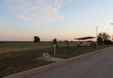
Site of Primrose School Marker image. Click for full size.
Photographed By Bill Kirchner, April 28, 2014
2. Site of Primrose School Marker
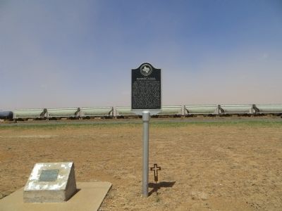
Site of Primrose School Marker image. Click for full size.
Photographed By Bill Kirchner, June 10, 2017
3. Site of Primrose School Marker
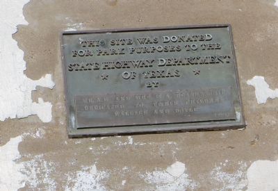
Dedication plaque at site of Primrose School Marker image. Click for full size.
Photographed By Bill Kirchner, April 28, 2014
4. Dedication plaque at site of Primrose School Marker
 
 
Credits. This page was last revised on August 11, 2017. It was originally submitted on May 8, 2014, by Bill Kirchner of Tucson, Arizona. This page has been viewed 673 times since then and 25 times this year. Photos:   1, 2. submitted on May 8, 2014, by Bill Kirchner of Tucson, Arizona.   3. submitted on August 2, 2017, by Bill Kirchner of Tucson, Arizona.   4. submitted on May 8, 2014, by Bill Kirchner of Tucson, Arizona. • Bernard Fisher was the editor who published this page.
Share this page.  
Share on Tumblr
m=73524

CeraNet Cloud Computing sponsors the Historical Marker Database.
This website earns income from purchases you make after using our links to Amazon.com. We appreciate your support.
Paid Advertisement
Apr. 20, 2024