Near Fennville in Allegan County, Michigan — The American Midwest (Great Lakes)
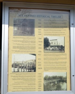
New Richmond Historical Timeline
- 1825 - Trading post established by Louis Campau (a Frenchman) at the mouth of the Rabbit River approximately one mile upstream from what is now New Richmond.
- 1825 - Mackís Landing trading post established where Purdyís Landing is now located. So begins this areaís notoriety as a main way point of goods being transferred up and down the Kalamazoo River.
- 1836 - John Allen, from Ann Arbor, comes to Allegan county and maps the first village in what is to become Manilus Township. He employs Ralph Mann to oversee the development of “Richmond City,” named after Allenís hometown of Richmond, Virginia.
- 1837 - After the prospect of Allenís city faded, Mann moves south one mile and builds the first hydro-powered wood mill in the area. Many more will follows.
- 1837 - First post office established in Richmond operating until 1839 before it is closed.
- 1838 - First settler, James McCormick, comes to Richmond. McCormick purchases 160 acres and begins lucrative fruit farming industry in the area.
- 1839 - Manilus Township is created through an act of legislation and the first township meeting is held at the home of Ralph Mann. John Allen is elected supervisor and Ralph Mann is elected Justice of the Peace.
- 1840's - As lumber and fruit industries are booming more residents come to New Richmond. John Gidley (1842), Jonathon Wade (1844), Asa and Norman Bowker (1845), Thomas and Daniel Lamoureux (1845) and others.
- 1842 - The first wooden bridge to connect the north and south banks of the Kalamazoo River is built. It collapses under the weight of an ox-cart in 1849.
- 1843 - Post office is opened in village of Manilus where it operates until 1872. It is then moved to the village of Richmond (developed by H.F. Marsh). Upon applying for designation it is learned that there is already a Richmond in Michigan (Macomb County) and the name was changed to “New Richmond.”
- 1856 - The second wooden bridge to connect the north and south banks of the Kalamazoo River is built, but it collapses under the weight of a stagecoach in 1877.
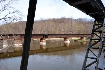
- 1871 - First railroad tracks made it to New Richmond. The Chicago & Michigan Lakeshore Railroad expands out to New Richmond to bring goods to the main shipping ports of Lake Michigan. This later becomes the Pere Marquette Line.
- 1874 - Manilus Village becomes less and less important. Ralph Mannís saw mill closes after the destruction of the mill race. Tavern located in Manilus burns to the ground. The station at New Richmond becomes center of activity.
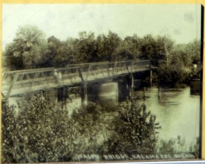
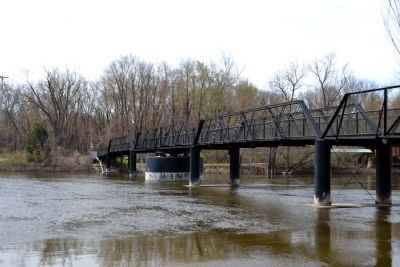
- 1879 - “New Richmond Bridge” is built at a cost of $5000. The new swing bridge is built the Milwaukee Iron Bridge Company and has a wooden deck with an iron frame.
- 1879 - Almost simultaneously the railroad builds a bridge next to the new swing bridge.
- 1880's - With lumber resources dwindling in the region, industry begins to slow down. Coal comes into use as a fuel and the demand for wood grows less on the market. The mills that do stay open concentrate on hard woods for the growing furniture industry in West Michigan.
- 1915 - Some time between 1915 and 1920, Paul Gamby is thought to have operated the swing bridge for the last time. The machinery then became encased in rust.
- 1976 - Allegan County closes the bridge to vehicular traffic. “Concerned Citizens for the New Richmond Bridge” is formed after hearing of plans for demolishing the bridge.
- 1979 - The bridge is re-opened after the citizen group and the County Road Commission collaborate on a renovation project. There was a parade of vintage cars passing over the bridge to commemorate the event.
- 1979 - The New Richmond Bridge is put on the State Register of Historic Places.
- 1997 - The New Richmond Bridge is once again closed to vehicular traffic by the Allegan Road Commission.
- 1998 - The New Richmond Bridge is put on the National Register of Historic Places.
- 2001 - Allegan County Road Commission receives federal funding for the complete restoration of the New Richmond swing bridge.
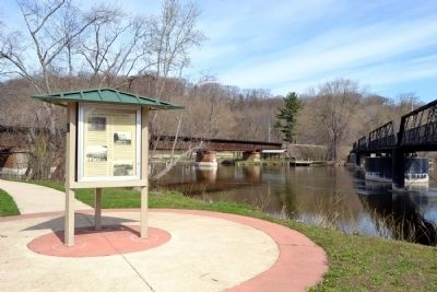
- 2004 - Restoration of the New Richmond Bridge is completed. The bridge, now open to pedestrian traffic only, will be the centerpiece for a new Allegan County Park.
Topics. This historical marker is listed in these topic lists: Bridges & Viaducts • Industry & Commerce • Railroads & Streetcars • Settlements & Settlers. A significant historical year for this entry is 1825.
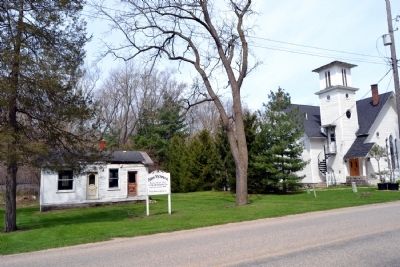
Location. 42° 39.06′ N, 86° 6.407′ W. Marker is near Fennville, Michigan, in Allegan County. Marker can be reached from Old Allegan Road, 0.2 miles north of 57th Street, on the left when traveling north. Marker is located near the south entrance to New Richmond Bridge County Park. Touch for map. Marker is in this post office area: Fennville MI 49408, United States of America. Touch for directions.
Other nearby markers. At least 8 other markers are within 5 miles of this marker, measured as the crow flies. The Railroad & New Richmond (about 300 feet away, measured in a direct line); New Richmond History (about 400 feet away); Fifty-Seventh Street Bridge (about 400 feet away); The Allegan Road (approx. 3.9 miles away); Welcome to River Bluff Park (approx. 3.9 miles away); Welcome to Fennville (approx. 3.9 miles away); All Saints Episcopal Church / Gordon W. Lloyd (approx. 4.8 miles away); Dutcher Lodge No. 193 / Douglas (approx. 4.9 miles away). Touch for a list and map of all markers in Fennville.
Also see . . .
1. New Richmond Bridge County Park. Allagan County website entry (Submitted on May 9, 2014.)
2. New Richmond Bridge / 57th Street Bridge
. From the HistoricBridges.org website. (Submitted on May 9, 2014.)
Credits. This page was last revised on April 5, 2022. It was originally submitted on May 9, 2014, by Duane Hall of Abilene, Texas. This page has been viewed 748 times since then and 33 times this year. Photos: 1, 2, 3, 4, 5, 6. submitted on May 9, 2014, by Duane Hall of Abilene, Texas.
