Summit in Union County, New Jersey — The American Northeast (Mid-Atlantic)
Signal Beacon and the “Old Sow”
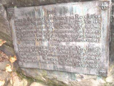
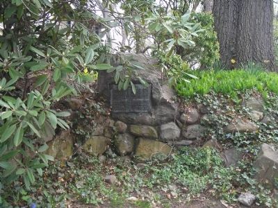
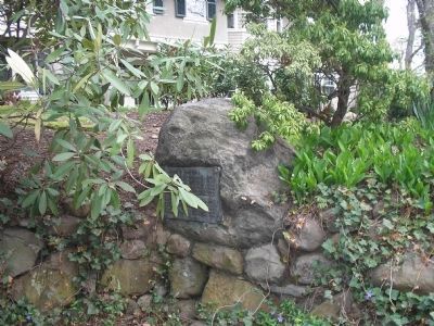
Here in the time of the American Revolution stood the Signal Beacon and by its side the cannon known as the “Old Sow” which in time of danger and invasion summoned the patriotic “Minute Men” of this vicinity to the defense of the country and the repulse of the invader.
This monument was erected by the New Jersey Society of the Sons of the American Revolution and dedicated to the memory of the patriots of New Jersey. Removed to this spot from its original location and re-dedicated July 4, 1908.
Erected 1896 by New Jersey Society of the Sons of the American Revolution.
Topics and series. This historical marker is listed in these topic lists: Patriots & Patriotism • War, US Revolutionary. In addition, it is included in the Sons of the American Revolution (SAR) series list. A significant historical date for this entry is July 4, 1882.
Location. 40° 43.602′ N, 74° 20.962′ W. Marker is in Summit, New Jersey, in Union County. Marker is on Hobart Avenue, on the right when traveling south. Touch for map. Marker is at or near this postal address: 226 Hobart Avenue, Summit NJ 07901, United States of America. Touch for directions.
Other nearby markers. At least 8 other markers are within 2 miles of this marker, measured as the crow flies. Summit Opera House (approx. 0.8 miles away); Rahway Valley Railroad (approx. 0.9 miles away); Florence Spearing Randolph (approx. 0.9 miles away); Wallace Chapel A.M.E. Zion Church (approx. 0.9 miles away); Briant Pond Park (approx. one mile away); Marjorie Cranstoun Jefferson (approx. 1.2 miles away); Summit Playhouse (approx. 1.2 miles away); Day's Bridge Summit (approx. 1.6 miles away). Touch for a list and map of all markers in Summit.
Also see . . . The Battles of Connecticut Farms and Springfield. (Submitted on April 26, 2008, by Bill Coughlin of Woodland Park, New Jersey.)
Credits. This page was last revised on June 16, 2016. It was originally submitted on April 26, 2008, by Bill Coughlin of Woodland Park, New Jersey. This page has been viewed 1,651 times since then and 49 times this year. Photos: 1, 2, 3. submitted on April 26, 2008, by Bill Coughlin of Woodland Park, New Jersey. • Craig Swain was the editor who published this page.


