Hamilton in Butler County, Ohio — The American Midwest (Great Lakes)
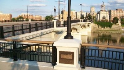
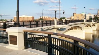
High-Main Street Bridge

Photographed By William Fischer, Jr., August 2, 2009
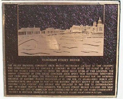
1. High-Main Street Bridge Marker
Urban Ohio website entry
Click for more information.
Click for more information.
The filled Spandrel concrete arch bridge previously located at this crossing was constructed by A.J. Yawger & Company in 1914 after the Flood of 1913. It was the fourth structure to cross the Great Miami River at this location. The bridge consisted of five equal concrete arch spans that extended ninety-five feet from span to span. The structure was considered eligible for the National Register of Historic Places individually in 1994 for its engineering design and construction, and later as part of the historic district known as the "Hamilton Historic Civic Center". The bridge was replaced in 2005 due to deterioration and increased traffic requirements. The Black Street Bridge located one mile north of the city of Hamilton and constructed in 1921 by the Miami Conservancy District is another example of early concrete filled arch construction.
Erected 2007 by the City of Hamilton.
Topics. This historical marker is listed in these topic lists: Bridges & Viaducts • Man-Made Features. A significant historical year for this entry is 1914.
Location. 39° 24.109′ N, 84° 33.984′ W. Marker is in Hamilton, Ohio, in Butler County. Marker is at the intersection of Main Street-High Street (Ohio Route 129/177) and the Ross Avenue Ramp, on the right when traveling east on Main Street-High Street. Marker is on the High-Main Street Bridge over the Great Miami River. Touch for map. Marker is in this post office area: Hamilton OH 45011, United States of America. Touch for directions.
Other nearby markers. At least 8 other markers are within walking distance of this marker. Earliest Industry (within shouting distance of this marker); The Dream of Hamiltonia (within shouting distance of this marker); Flood & Recovery (within shouting distance of this marker); Hamilton Hydraulic (within shouting distance of this marker); Flatboats and Early Trade (about 300 feet away, measured in a direct line); Site of Fort Hamilton (about 400 feet away); Rossville Historic District (about 400 feet away); French Exploration (about 500 feet away). Touch for a list and map of all markers in Hamilton.
More about this marker. An identical marker is located at the east approach to the bridge.
Also see . . . High-Main Street Bridge. Burgess & Niple website entry (Submitted on February 2, 2024, by Larry Gertner of New York, New York.)
Credits. This page was last revised on February 2, 2024. It was originally submitted on May 10, 2014, by William Fischer, Jr. of Scranton, Pennsylvania. This page has been viewed 806 times since then and 90 times this year. Photos: 1, 2, 3. submitted on May 10, 2014, by William Fischer, Jr. of Scranton, Pennsylvania.

