Catlettsburg in Boyd County, Kentucky — The American South (East South Central)
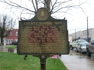
County Named, 1860
Erected 1964 by Kentucky Historical Society-Kentucky Department of Highways. (Marker Number 772.)
Topics and series. This historical marker is listed in these topic lists: Government & Politics • Settlements & Settlers. In addition, it is included in the Kentucky Historical Society series list. A significant historical year for this entry is 1800.
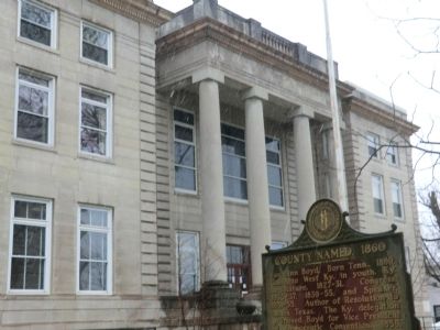
Location. 38° 24.9′ N, 82° 35.868′ W. Marker is in Catlettsburg, Kentucky, in Boyd County. Marker is on Louisa Street. The marker is on the grounds of the Boyd County Courthouse. Touch for map. Marker is in this post office area: Catlettsburg KY 41129, United States of America. Touch for directions.
Other nearby markers. At least 8 other markers are within walking distance of this marker. Country Music Highway (within shouting distance of this marker); Judge John M. Elliott (about 300 feet away, measured in a direct line); Mary Elliott Flanery (about 500 feet away); Civil War Army Base (about 700 feet away); Chesapeake & Ohio Passenger Station (approx. 0.2 miles away); William Davidson (approx. 0.6 miles away in Ohio); Dreamland Pool (approx. 0.9 miles away in West Virginia); West Virginia (Wayne County) / Kentucky (approx. 0.9 miles away in West Virginia). Touch for a list and map of all markers in Catlettsburg.
Credits. This page was last revised on October 5, 2020. It was originally submitted on May 16, 2014, by Don Morfe of Baltimore, Maryland. This page has been viewed 480 times since then and 14 times this year. Photos: 1, 2. submitted on May 16, 2014, by Don Morfe of Baltimore, Maryland. • Bill Pfingsten was the editor who published this page.

