Near Worley in Monongalia County, West Virginia — The American South (Appalachia)
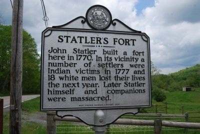
Statler's Fort
Erected 2009 by West Virginia Archives & History.
Topics and series. This historical marker is listed in these topic lists: Forts and Castles • Native Americans. In addition, it is included in the West Virginia Archives and History series list. A significant historical year for this entry is 1770.
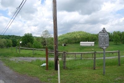
Location. Marker has been reported permanently removed. It was located near 39° 42.761′ N, 80° 8.261′ W. Marker was near Worley, West Virginia, in Monongalia County. Marker was on Mason Dixon Highway (West Virginia Route 7) 0.4 miles west of Mooresville Road, on the right when traveling west. Touch for map. Marker was at or near this postal address: 3831 WV-7, Maidsville WV 26541, United States of America.
We have been informed that this sign or monument is no longer there and will not be replaced. This page is an archival view of what was.
Other nearby markers. At least 8 other markers are within 4 miles of this location, measured as the crow flies. A different marker also named Statler's Fort (here, next to this marker); Price Memorial Cemetery (approx. 0.4 miles away); Veterans Memorial (approx. 0.9 miles away); Border Heroine (approx. 1.1 miles away); Shanks Mill (approx. 1.3 miles away); Catawba War Path (approx. 1.7 miles away); The F-84F Thunderstreak (approx. 3.4 miles away); Civil War Monument (approx. 3.7 miles away in Pennsylvania).
Credits. This page was last revised on April 27, 2022. It was originally submitted on May 17, 2014, by Mike Wintermantel of Pittsburgh, Pennsylvania. This page has been viewed 1,180 times since then and 29 times this year. Last updated on April 27, 2022, by Bradley Owen of Morgantown, West Virginia. Photos: 1, 2. submitted on May 17, 2014, by Mike Wintermantel of Pittsburgh, Pennsylvania. • Devry Becker Jones was the editor who published this page.

